

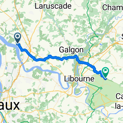
45.001° N -0.461° W to 44.971° N -0.463° W
A cycling route starting in Saint-Gervais, Nouvelle-Aquitaine, France.
Overview
About this route
- 18 min
- Duration
- 4.4 km
- Distance
- 10 m
- Ascent
- 39 m
- Descent
- 14.5 km/h
- Avg. speed
- 33 m
- Max. altitude
Route quality
Waytypes & surfaces along the route
Waytypes
Quiet road
4.3 km
(99 %)
Road
0 km
(1 %)
Undefined
0 km
(<1 %)
Surfaces
Paved
0.4 km
(9 %)
Asphalt
0.4 km
(9 %)
Undefined
4 km
(91 %)
Continue with Bikemap
Use, edit, or download this cycling route
You would like to ride 45.001° N -0.461° W to 44.971° N -0.463° W or customize it for your own trip? Here is what you can do with this Bikemap route:
Free features
- Save this route as favorite or in collections
- Copy & plan your own version of this route
- Sync your route with Garmin or Wahoo
Premium features
Free trial for 3 days, or one-time payment. More about Bikemap Premium.
- Navigate this route on iOS & Android
- Export a GPX / KML file of this route
- Create your custom printout (try it for free)
- Download this route for offline navigation
Discover more Premium features.
Get Bikemap PremiumFrom our community
Other popular routes starting in Saint-Gervais
 From Saint-André-de-Cubzac to Saint-Emilion
- Distance
- 37.9 km
- Ascent
- 243 m
- Descent
- 221 m
- Location
- Saint-Gervais, Nouvelle-Aquitaine, France
 St A Marandin 44km
- Distance
- 43.8 km
- Ascent
- 216 m
- Descent
- 213 m
- Location
- Saint-Gervais, Nouvelle-Aquitaine, France
 De Rue du Coteau 5, Saint-André-de-Cubzac à Rue du Coteau 4, Saint-André-de-Cubzac
- Distance
- 25.3 km
- Ascent
- 237 m
- Descent
- 300 m
- Location
- Saint-Gervais, Nouvelle-Aquitaine, France
 trip vélo octobre
- Distance
- 163 km
- Ascent
- 589 m
- Descent
- 617 m
- Location
- Saint-Gervais, Nouvelle-Aquitaine, France
 Itinéraire vers Route de Thouil, Villegouge
- Distance
- 14.2 km
- Ascent
- 87 m
- Descent
- 97 m
- Location
- Saint-Gervais, Nouvelle-Aquitaine, France
 ST A Bour 45K/290
- Distance
- 44.6 km
- Ascent
- 274 m
- Descent
- 274 m
- Location
- Saint-Gervais, Nouvelle-Aquitaine, France
 De Rue du Coteau 1, Saint-André-de-Cubzac à Rue du Coteau 4, Saint-André-de-Cubzac
- Distance
- 28.4 km
- Ascent
- 177 m
- Descent
- 177 m
- Location
- Saint-Gervais, Nouvelle-Aquitaine, France
 St A Plassac nord 52Km
- Distance
- 52.5 km
- Ascent
- 322 m
- Descent
- 321 m
- Location
- Saint-Gervais, Nouvelle-Aquitaine, France
Open it in the app