

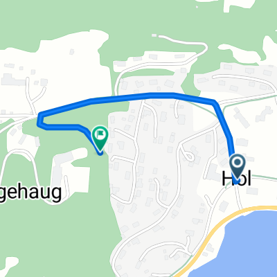
Hol - Sylling
A cycling route starting in Hol, Buskerud, Norway.
Overview
About this route
- -:--
- Duration
- 225 km
- Distance
- 3,316 m
- Ascent
- 3,723 m
- Descent
- ---
- Avg. speed
- 592 m
- Max. altitude

Route quality
Waytypes & surfaces along the route
Waytypes
Quiet road
72.6 km
(32 %)
Busy road
69.6 km
(31 %)
Surfaces
Paved
116.1 km
(52 %)
Unpaved
23.7 km
(11 %)
Asphalt
113.2 km
(50 %)
Gravel
18 km
(8 %)
Route highlights
Points of interest along the route
Photo after 10.3 km
Point of interest after 16.8 km
epicerie
Photo after 112.3 km
Photo after 163.4 km
Point of interest after 222.5 km
Épicerie
Photo after 223.3 km
Continue with Bikemap
Use, edit, or download this cycling route
You would like to ride Hol - Sylling or customize it for your own trip? Here is what you can do with this Bikemap route:
Free features
- Save this route as favorite or in collections
- Copy & plan your own version of this route
- Split it into stages to create a multi-day tour
- Sync your route with Garmin or Wahoo
Premium features
Free trial for 3 days, or one-time payment. More about Bikemap Premium.
- Navigate this route on iOS & Android
- Export a GPX / KML file of this route
- Create your custom printout (try it for free)
- Download this route for offline navigation
Discover more Premium features.
Get Bikemap PremiumFrom our community
Other popular routes starting in Hol
 Orginal Geilo-Gol
- Distance
- 47.8 km
- Ascent
- 0 m
- Descent
- 0 m
- Location
- Hol, Buskerud, Norway
 Hemsedal og tilbake
- Distance
- 94.3 km
- Ascent
- 1,352 m
- Descent
- 1,469 m
- Location
- Hol, Buskerud, Norway
 Hol - Hemsedal
- Distance
- 56.2 km
- Ascent
- 1,041 m
- Descent
- 969 m
- Location
- Hol, Buskerud, Norway
 Hallingdalsruta: Geilo - Drammen
- Distance
- 220.7 km
- Ascent
- 1,236 m
- Descent
- 1,766 m
- Location
- Hol, Buskerud, Norway
 Hallingdalsruta: Geilo - Drammen
- Distance
- 220.7 km
- Ascent
- 293 m
- Descent
- 284 m
- Location
- Hol, Buskerud, Norway
 Kongshaugen
- Distance
- 0.8 km
- Ascent
- 240 m
- Descent
- 240 m
- Location
- Hol, Buskerud, Norway
 Skarverittet 2011 Elite
- Distance
- 52.3 km
- Ascent
- 1,771 m
- Descent
- 1,511 m
- Location
- Hol, Buskerud, Norway
 Hol - Sylling
- Distance
- 225 km
- Ascent
- 3,316 m
- Descent
- 3,723 m
- Location
- Hol, Buskerud, Norway
Open it in the app