

Lannach-Tour
A cycling route starting in Preding, Styria, Austria.
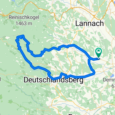
Overview
About this route
On the Lannach Tour, we experience beautiful panoramic routes, lovely and peaceful sections through idyllic woodland, a great recreational area by the Wundschuher ponds, the pumpkin village Preding with its pumpkin mayor, excellent culinary hospitality, a riding village as well as an impressive distillery and a unique horticultural business. The visit to a large ostrich farm in Lannach (district Oberblumegg) forms a worthy highlight along the Lannach Tour.
- -:--
- Duration
- 48.5 km
- Distance
- 636 m
- Ascent
- 639 m
- Descent
- ---
- Avg. speed
- 432 m
- Max. altitude
Route quality
Waytypes & surfaces along the route
Waytypes
Quiet road
28.6 km
(59 %)
Road
10.7 km
(22 %)
Surfaces
Paved
30.6 km
(63 %)
Unpaved
1.5 km
(3 %)
Asphalt
30.1 km
(62 %)
Unpaved (undefined)
1 km
(2 %)
Continue with Bikemap
Use, edit, or download this cycling route
You would like to ride Lannach-Tour or customize it for your own trip? Here is what you can do with this Bikemap route:
Free features
- Save this route as favorite or in collections
- Copy & plan your own version of this route
- Sync your route with Garmin or Wahoo
Premium features
Free trial for 3 days, or one-time payment. More about Bikemap Premium.
- Navigate this route on iOS & Android
- Export a GPX / KML file of this route
- Create your custom printout (try it for free)
- Download this route for offline navigation
Discover more Premium features.
Get Bikemap PremiumFrom our community
Other popular routes starting in Preding
 Preding - Stainz und zurück
- Distance
- 55.6 km
- Ascent
- 502 m
- Descent
- 503 m
- Location
- Preding, Styria, Austria
 Wetz-KAT2
- Distance
- 46.7 km
- Ascent
- 249 m
- Descent
- 247 m
- Location
- Preding, Styria, Austria
 Lannach-Tour - Lannach-Tour
- Distance
- 48.4 km
- Ascent
- 683 m
- Descent
- 683 m
- Location
- Preding, Styria, Austria
 Wetzelsdorf 5, Wetzelsdorf in der Weststeiermark nach Wetzelsdorf 2, Wetzelsdorf in der Weststeiermark
- Distance
- 16.9 km
- Ascent
- 307 m
- Descent
- 319 m
- Location
- Preding, Styria, Austria
 GKB Begleitweg Preding Frauental
- Distance
- 38.8 km
- Ascent
- 93 m
- Descent
- 93 m
- Location
- Preding, Styria, Austria
 Wetzelsdorf 5, Wetzelsdorf in der Weststeiermark nach Wetzelsdorf 5, Wetzelsdorf in der Weststeiermark
- Distance
- 12.2 km
- Ascent
- 211 m
- Descent
- 211 m
- Location
- Preding, Styria, Austria
 Wetzelsdorf 5, Wetzelsdorf in der Weststeiermark nach Wetzelsdorf 5, Wetzelsdorf in der Weststeiermark
- Distance
- 17.2 km
- Ascent
- 508 m
- Descent
- 496 m
- Location
- Preding, Styria, Austria
 Sallegg-Freiland
- Distance
- 71.3 km
- Ascent
- 1,556 m
- Descent
- 1,555 m
- Location
- Preding, Styria, Austria
Open it in the app