

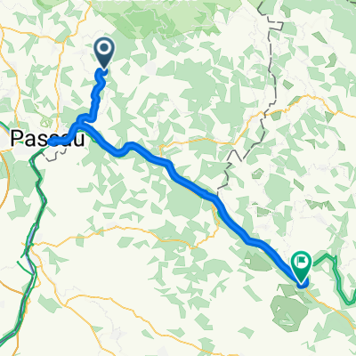
2005 - Passau - Györ - Übersicht
A cycling route starting in Thyrnau, Bavaria, Germany.
Overview
About this route
- -:--
- Duration
- 516.7 km
- Distance
- 153 m
- Ascent
- 371 m
- Descent
- ---
- Avg. speed
- ---
- Max. altitude

Route highlights
Points of interest along the route
Accommodation after 85.4 km
Accommodation after 147.8 km
Accommodation after 211.2 km
Accommodation after 259.5 km
Accommodation after 329.5 km
Accommodation after 397.1 km
Accommodation after 465.3 km
Continue with Bikemap
Use, edit, or download this cycling route
You would like to ride 2005 - Passau - Györ - Übersicht or customize it for your own trip? Here is what you can do with this Bikemap route:
Free features
- Save this route as favorite or in collections
- Copy & plan your own version of this route
- Split it into stages to create a multi-day tour
- Sync your route with Garmin or Wahoo
Premium features
Free trial for 3 days, or one-time payment. More about Bikemap Premium.
- Navigate this route on iOS & Android
- Export a GPX / KML file of this route
- Create your custom printout (try it for free)
- Download this route for offline navigation
Discover more Premium features.
Get Bikemap PremiumFrom our community
Other popular routes starting in Thyrnau
 Kellberg - Klafferstrass-Kellberg
- Distance
- 87.1 km
- Ascent
- 1,894 m
- Descent
- 1,893 m
- Location
- Thyrnau, Bavaria, Germany
 Steco 2
- Distance
- 50.3 km
- Ascent
- 842 m
- Descent
- 814 m
- Location
- Thyrnau, Bavaria, Germany
 Rowerem wzdłuż Dunaju - 14.07.2013 r.
- Distance
- 55.9 km
- Ascent
- 621 m
- Descent
- 787 m
- Location
- Thyrnau, Bavaria, Germany
 Rowerem wzdłuż Dunaju - 14.07.2013 r.
- Distance
- 55.9 km
- Ascent
- 477 m
- Descent
- 643 m
- Location
- Thyrnau, Bavaria, Germany
 Kellberg - Buechlberg - Runde
- Distance
- 27.2 km
- Ascent
- 503 m
- Descent
- 503 m
- Location
- Thyrnau, Bavaria, Germany
 Steco 1
- Distance
- 48.6 km
- Ascent
- 771 m
- Descent
- 780 m
- Location
- Thyrnau, Bavaria, Germany
 Steco 4
- Distance
- 31.5 km
- Ascent
- 384 m
- Descent
- 380 m
- Location
- Thyrnau, Bavaria, Germany
 Obernzell-Oberachleiten-Kneiding- Schartenberg -Ingling - Passau - Kellber
- Distance
- 55.2 km
- Ascent
- 1,273 m
- Descent
- 1,261 m
- Location
- Thyrnau, Bavaria, Germany
Open it in the app