

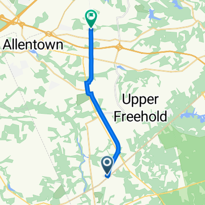
17 mile emery cookstown
A cycling route starting in New Egypt, New Jersey, United States.
Overview
About this route
- -:--
- Duration
- 27.7 km
- Distance
- 108 m
- Ascent
- 109 m
- Descent
- ---
- Avg. speed
- 46 m
- Max. altitude
Route photos

Route quality
Waytypes & surfaces along the route
Waytypes
Road
12 km
(43 %)
Quiet road
10.9 km
(40 %)
Continue with Bikemap
Use, edit, or download this cycling route
You would like to ride 17 mile emery cookstown or customize it for your own trip? Here is what you can do with this Bikemap route:
Free features
- Save this route as favorite or in collections
- Copy & plan your own version of this route
- Sync your route with Garmin or Wahoo
Premium features
Free trial for 3 days, or one-time payment. More about Bikemap Premium.
- Navigate this route on iOS & Android
- Export a GPX / KML file of this route
- Create your custom printout (try it for free)
- Download this route for offline navigation
Discover more Premium features.
Get Bikemap PremiumFrom our community
Other popular routes starting in New Egypt
 Hornerstown Road 20, Plumsted Township to Hornerstown Road 20, Plumsted Township
- Distance
- 17.4 km
- Ascent
- 9 m
- Descent
- 13 m
- Location
- New Egypt, New Jersey, United States
 Wrightstown/Cookstown
- Distance
- 33.7 km
- Ascent
- 72 m
- Descent
- 74 m
- Location
- New Egypt, New Jersey, United States
 17 mile emery cookstown
- Distance
- 27.7 km
- Ascent
- 108 m
- Descent
- 109 m
- Location
- New Egypt, New Jersey, United States
 UTTrail
- Distance
- 28.5 km
- Ascent
- 3 m
- Descent
- 5 m
- Location
- New Egypt, New Jersey, United States
 wrightstown nj
- Distance
- 17.4 km
- Ascent
- 2 m
- Descent
- 6 m
- Location
- New Egypt, New Jersey, United States
 145 Long Swamp Rd, New Egypt to 140 Long Swamp Rd, New Egypt
- Distance
- 29.8 km
- Ascent
- 125 m
- Descent
- 124 m
- Location
- New Egypt, New Jersey, United States
 8 Millstream Rd, Cream Ridge to Union Transportation Trail, Trenton
- Distance
- 11.5 km
- Ascent
- 60 m
- Descent
- 62 m
- Location
- New Egypt, New Jersey, United States
 114 Leanne Dr, New Egypt to 100 Beach Ave, Cape May
- Distance
- 160 km
- Ascent
- 457 m
- Descent
- 510 m
- Location
- New Egypt, New Jersey, United States
Open it in the app