

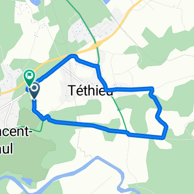
B32 Compostelle Saint Vincent de Paul - Bayonne
A cycling route starting in Saint-Vincent-de-Paul, Nouvelle-Aquitaine, France.
Overview
About this route
- 4 h 33 min
- Duration
- 72.4 km
- Distance
- 365 m
- Ascent
- 375 m
- Descent
- 15.9 km/h
- Avg. speed
- 47 m
- Max. altitude

Route quality
Waytypes & surfaces along the route
Waytypes
Quiet road
38 km
(52 %)
Path
10.5 km
(14 %)
Surfaces
Paved
30.6 km
(42 %)
Unpaved
3 km
(4 %)
Asphalt
29.6 km
(41 %)
Gravel
2.7 km
(4 %)
Continue with Bikemap
Use, edit, or download this cycling route
You would like to ride B32 Compostelle Saint Vincent de Paul - Bayonne or customize it for your own trip? Here is what you can do with this Bikemap route:
Free features
- Save this route as favorite or in collections
- Copy & plan your own version of this route
- Sync your route with Garmin or Wahoo
Premium features
Free trial for 3 days, or one-time payment. More about Bikemap Premium.
- Navigate this route on iOS & Android
- Export a GPX / KML file of this route
- Create your custom printout (try it for free)
- Download this route for offline navigation
Discover more Premium features.
Get Bikemap PremiumFrom our community
Other popular routes starting in Saint-Vincent-de-Paul
 De Route de Coustaou 479, Saint-Vincent-de-Paul à Impasse du Moulin 1039, Saint-Vincent-de-Paul
- Distance
- 7.6 km
- Ascent
- 69 m
- Descent
- 74 m
- Location
- Saint-Vincent-de-Paul, Nouvelle-Aquitaine, France
 premier petit tour 🚴♂️🚴♂️
- Distance
- 4.3 km
- Ascent
- 18 m
- Descent
- 17 m
- Location
- Saint-Vincent-de-Paul, Nouvelle-Aquitaine, France
 Recovered Route
- Distance
- 68.9 km
- Ascent
- 165 m
- Descent
- 172 m
- Location
- Saint-Vincent-de-Paul, Nouvelle-Aquitaine, France
 velo course De Impasse du Moulin 1039, Saint-Vincent-de-Paul à Avenue des Platanes 1039, Saint-Vincent-de-Paul
- Distance
- 30.2 km
- Ascent
- 126 m
- Descent
- 134 m
- Location
- Saint-Vincent-de-Paul, Nouvelle-Aquitaine, France
 reprise n1
- Distance
- 7.5 km
- Ascent
- 25 m
- Descent
- 0 m
- Location
- Saint-Vincent-de-Paul, Nouvelle-Aquitaine, France
 De Route de Herm 100, Gourbera à Rue du Bourg 50, Gourbera
- Distance
- 9.9 km
- Ascent
- 107 m
- Descent
- 36 m
- Location
- Saint-Vincent-de-Paul, Nouvelle-Aquitaine, France
 14 Rue Colette Besson, Pontonx-sur-l'Adour à Rue Colette Besson, Pontonx-sur-l'Adour
- Distance
- 10.3 km
- Ascent
- 65 m
- Descent
- 60 m
- Location
- Saint-Vincent-de-Paul, Nouvelle-Aquitaine, France
 rondje Dax Urt
- Distance
- 115.8 km
- Ascent
- 268 m
- Descent
- 268 m
- Location
- Saint-Vincent-de-Paul, Nouvelle-Aquitaine, France
Open it in the app