

Bend rides
Cascade Cycling Classic 2010 - Men Stage 3
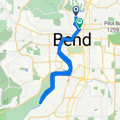
A cycling route starting in Bend, Oregon, United States.
Overview
About this route
- -:--
- Duration
- 71 km
- Distance
- 1,080 m
- Ascent
- 1,078 m
- Descent
- ---
- Avg. speed
- 1,985 m
- Max. altitude

Part of
Bend rides
3 stages
Route quality
Waytypes & surfaces along the route
Waytypes
Path
11.4 km
(16 %)
Road
3.6 km
(5 %)
Surfaces
Paved
49 km
(69 %)
Unpaved
7.8 km
(11 %)
Asphalt
46.9 km
(66 %)
Ground
7.1 km
(10 %)
Route highlights
Points of interest along the route
Point of interest after 21 km
Wanoga Sno Park
Point of interest after 32.5 km
Feedzone
Point of interest after 34.1 km
Feedzone
Point of interest after 35.5 km
Sprint
Point of interest after 44.2 km
Feedzone
Point of interest after 46.6 km
KOM - Category 3
Continue with Bikemap
Use, edit, or download this cycling route
You would like to ride Cascade Cycling Classic 2010 - Men Stage 3 or customize it for your own trip? Here is what you can do with this Bikemap route:
Free features
- Save this route as favorite or in collections
- Copy & plan your own version of this route
- Sync your route with Garmin or Wahoo
Premium features
Free trial for 3 days, or one-time payment. More about Bikemap Premium.
- Navigate this route on iOS & Android
- Export a GPX / KML file of this route
- Create your custom printout (try it for free)
- Download this route for offline navigation
Discover more Premium features.
Get Bikemap PremiumFrom our community
Other popular routes starting in Bend
 Bend River Route
- Distance
- 14.3 km
- Ascent
- 80 m
- Descent
- 79 m
- Location
- Bend, Oregon, United States
 Untitled route
- Distance
- 7.4 km
- Ascent
- 67 m
- Descent
- 195 m
- Location
- Bend, Oregon, United States
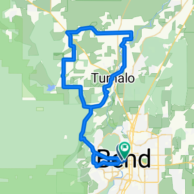
 Bend to Tumalo Falls (Dropbar)
- Distance
- 42.7 km
- Ascent
- 640 m
- Descent
- 639 m
- Location
- Bend, Oregon, United States
 475 NE Bellevue Dr, Bend to 500 NE Dalton St, Bend
- Distance
- 16.1 km
- Ascent
- 95 m
- Descent
- 89 m
- Location
- Bend, Oregon, United States
 Cascade Cycling Classic 2010 - Men Stage 3
- Distance
- 71 km
- Ascent
- 1,080 m
- Descent
- 1,078 m
- Location
- Bend, Oregon, United States
 Twin Bridges Scenic -Bend to Tumalo
- Distance
- 58.7 km
- Ascent
- 561 m
- Descent
- 563 m
- Location
- Bend, Oregon, United States
 Cascades100-2017
- Distance
- 160.4 km
- Ascent
- 2,118 m
- Descent
- 2,118 m
- Location
- Bend, Oregon, United States
 NW Perspective Dr, Bend to NW Perspective Dr, Bend
- Distance
- 18.5 km
- Ascent
- 195 m
- Descent
- 195 m
- Location
- Bend, Oregon, United States
Open it in the app