

Dia 10 (ER²)
A cycling route starting in Caeté, Minas Gerais, Brazil.
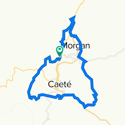
Overview
About this route
18/04 - Centro Histórico de Barão de Cocais
• Santuario São João Batista • Igreja do Rosário
18/04 - Centro Histórico de Santa Bárbara
• Igreja Nossa Senhora das Merces • Antigua Estación de Ferrocarril • Igreja Matriz de Santo Antônio • Casa da Rua Rabelo Horta
18/04 - Igreja Matriz de Santo Amaro (Brumal)
18/04 - Pousada cerca de la entrada o dentro del Santuario do Caraça
- -:--
- Duration
- 57.1 km
- Distance
- 1,430 m
- Ascent
- 1,640 m
- Descent
- ---
- Avg. speed
- 1,178 m
- Max. altitude

Route quality
Waytypes & surfaces along the route
Waytypes
Quiet road
28 km
(49 %)
Road
6.8 km
(12 %)
Surfaces
Paved
19.4 km
(34 %)
Unpaved
16 km
(28 %)
Unpaved (undefined)
14.3 km
(25 %)
Asphalt
11.4 km
(20 %)
Route highlights
Points of interest along the route
Point of interest after 1.1 km
Photo after 31 km
Santuário São João Batista
Photo after 32.8 km
Igreja do Rosário
Photo after 42 km
Antiga Estação Ferroviária
Photo after 42.3 km
Igreja Matriz de Santo Antônio
Photo after 42.5 km
Casa da Rua Rabelo Horta
Point of interest after 43 km
Igreja Nossa Senhora das Merces
Accommodation after 57 km
Continue with Bikemap
Use, edit, or download this cycling route
You would like to ride Dia 10 (ER²) or customize it for your own trip? Here is what you can do with this Bikemap route:
Free features
- Save this route as favorite or in collections
- Copy & plan your own version of this route
- Sync your route with Garmin or Wahoo
Premium features
Free trial for 3 days, or one-time payment. More about Bikemap Premium.
- Navigate this route on iOS & Android
- Export a GPX / KML file of this route
- Create your custom printout (try it for free)
- Download this route for offline navigation
Discover more Premium features.
Get Bikemap PremiumFrom our community
Other popular routes starting in Caeté
 rota do ferro test
- Distance
- 100.6 km
- Ascent
- 889 m
- Descent
- 888 m
- Location
- Caeté, Minas Gerais, Brazil
 Juca Vieira - Caeté - MG
- Distance
- 15.2 km
- Ascent
- 241 m
- Descent
- 246 m
- Location
- Caeté, Minas Gerais, Brazil
 Rancho-Novo...
- Distance
- 29.7 km
- Ascent
- 951 m
- Descent
- 929 m
- Location
- Caeté, Minas Gerais, Brazil
 Trilha - Pompeu de Sabará - Amigos do Pedal
- Distance
- 17.1 km
- Ascent
- 496 m
- Descent
- 503 m
- Location
- Caeté, Minas Gerais, Brazil
 Pousada Berra Lobo: curto-circuito
- Distance
- 4.6 km
- Ascent
- 202 m
- Descent
- 205 m
- Location
- Caeté, Minas Gerais, Brazil
 Dia 10 (ER²)
- Distance
- 57.1 km
- Ascent
- 1,430 m
- Descent
- 1,640 m
- Location
- Caeté, Minas Gerais, Brazil
 Volta em Caeté
- Distance
- 20.5 km
- Ascent
- 710 m
- Descent
- 710 m
- Location
- Caeté, Minas Gerais, Brazil
 Poli - Rota do ferro - Serra da Piedade - Poli
- Distance
- 49.2 km
- Ascent
- 1,389 m
- Descent
- 1,388 m
- Location
- Caeté, Minas Gerais, Brazil
Open it in the app