

Overview
About this route
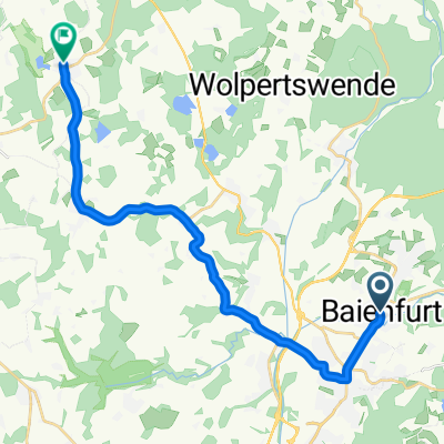
Fourth stage of the KLB cycling pilgrimage from Baienfurt to Eschlikon
- -:--
- Duration
- 82.4 km
- Distance
- 602 m
- Ascent
- 494 m
- Descent
- ---
- Avg. speed
- 588 m
- Max. altitude

Part of
Radwallfahrt 2022
7 stages
Route highlights
Points of interest along the route
Point of interest after 47.5 km
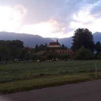
Bruder Klaus Gedenkstein
Continue with Bikemap
Use, edit, or download this cycling route
You would like to ride RWF 2022 4. Tag or customize it for your own trip? Here is what you can do with this Bikemap route:
Free features
- Save this route as favorite or in collections
- Copy & plan your own version of this route
- Split it into stages to create a multi-day tour
- Sync your route with Garmin or Wahoo
Premium features
Free trial for 3 days, or one-time payment. More about Bikemap Premium.
- Navigate this route on iOS & Android
- Export a GPX / KML file of this route
- Create your custom printout (try it for free)
- Download this route for offline navigation
Discover more Premium features.
Get Bikemap PremiumFrom our community
Other popular routes starting in Baienfurt
 Fronhofen-Zoggenweiler-Hefigkofen-Ravensburg
- Distance
- 40.1 km
- Ascent
- 368 m
- Descent
- 368 m
- Location
- Baienfurt, Baden-Wurttemberg, Germany
 Route in Baienfurt
- Distance
- 17.4 km
- Ascent
- 95 m
- Descent
- 93 m
- Location
- Baienfurt, Baden-Wurttemberg, Germany
 Lindele Rösslerweiher
- Distance
- 4.3 km
- Ascent
- 90 m
- Descent
- 90 m
- Location
- Baienfurt, Baden-Wurttemberg, Germany
 2013-07-26 bis 2013-08-02 Gotthard-Tour
- Distance
- 486.6 km
- Ascent
- 2,703 m
- Descent
- 3,165 m
- Location
- Baienfurt, Baden-Wurttemberg, Germany
 2003-Pfingsten
- Distance
- 354.5 km
- Ascent
- 2,788 m
- Descent
- 3,066 m
- Location
- Baienfurt, Baden-Wurttemberg, Germany
 Lazarettstraße 48, Weingarten nach Lazarettstraße 48, Weingarten
- Distance
- 45.8 km
- Ascent
- 362 m
- Descent
- 362 m
- Location
- Baienfurt, Baden-Wurttemberg, Germany
 Waldsee - Mattenhaus
- Distance
- 70.9 km
- Ascent
- 438 m
- Descent
- 346 m
- Location
- Baienfurt, Baden-Wurttemberg, Germany
 ebenweiler
- Distance
- 19.7 km
- Ascent
- 240 m
- Descent
- 111 m
- Location
- Baienfurt, Baden-Wurttemberg, Germany
Open it in the app