

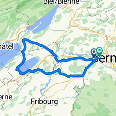
Emmentaler-Hogerderby
A cycling route starting in Köniz, Canton of Bern, Switzerland.
Overview
About this route
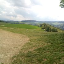
A very nice round trip through the Emmental, with beautiful transitions and very nice views; the route is good to ride in both directions. There is always the option to ride in the valley on the main road, which has less elevation gain, but more traffic and less scenery. Or you can always switch to public transport.
- -:--
- Duration
- 127.8 km
- Distance
- 1,615 m
- Ascent
- 1,615 m
- Descent
- ---
- Avg. speed
- ---
- Max. altitude

Route quality
Waytypes & surfaces along the route
Waytypes
Quiet road
65.2 km
(51 %)
Road
17.9 km
(14 %)
Surfaces
Paved
74.1 km
(58 %)
Unpaved
2.6 km
(2 %)
Asphalt
67.7 km
(53 %)
Paved (undefined)
6.4 km
(5 %)
Continue with Bikemap
Use, edit, or download this cycling route
You would like to ride Emmentaler-Hogerderby or customize it for your own trip? Here is what you can do with this Bikemap route:
Free features
- Save this route as favorite or in collections
- Copy & plan your own version of this route
- Split it into stages to create a multi-day tour
- Sync your route with Garmin or Wahoo
Premium features
Free trial for 3 days, or one-time payment. More about Bikemap Premium.
- Navigate this route on iOS & Android
- Export a GPX / KML file of this route
- Create your custom printout (try it for free)
- Download this route for offline navigation
Discover more Premium features.
Get Bikemap PremiumFrom our community
Other popular routes starting in Köniz
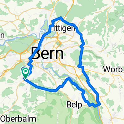
 Köniz-Bremgartenwald-Wohlensee-Wohleiberg-Köniz by mnh
- Distance
- 36.4 km
- Ascent
- 466 m
- Descent
- 465 m
- Location
- Köniz, Canton of Bern, Switzerland
 C60+ Borisried-Bütschelegg-Nebel-Sonne
- Distance
- 49.1 km
- Ascent
- 825 m
- Descent
- 895 m
- Location
- Köniz, Canton of Bern, Switzerland
 Sensetour by mnh
- Distance
- 40.1 km
- Ascent
- 425 m
- Descent
- 425 m
- Location
- Köniz, Canton of Bern, Switzerland
 Emmentaler-Hogerderby
- Distance
- 127.8 km
- Ascent
- 1,615 m
- Descent
- 1,615 m
- Location
- Köniz, Canton of Bern, Switzerland
 De Dorfbachstrasse 58, Köniz a Dorfbachstrasse 60, Köniz
- Distance
- 63.5 km
- Ascent
- 1,079 m
- Descent
- 1,079 m
- Location
- Köniz, Canton of Bern, Switzerland
 888 Grünes Band Bern modifiè
- Distance
- 40.9 km
- Ascent
- 619 m
- Descent
- 619 m
- Location
- Köniz, Canton of Bern, Switzerland
 Berner Hügelweg 3 GCL links Var.1
- Distance
- 46.3 km
- Ascent
- 1,084 m
- Descent
- 1,081 m
- Location
- Köniz, Canton of Bern, Switzerland
 Da Neue Murtenstrasse a Bühlstrasse
- Distance
- 89.1 km
- Ascent
- 640 m
- Descent
- 630 m
- Location
- Köniz, Canton of Bern, Switzerland
Open it in the app