

2ème étape Crête des Vosges
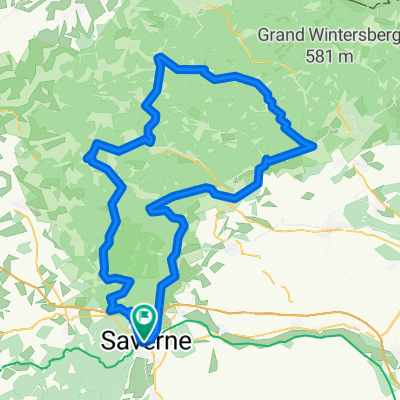
A cycling route starting in Saverne, Grand Est, France.
Overview
About this route
the second day:
Col du Donon (500Hm), Champs du Feu (700 - can be skipped!), Col de Fouchy (300), otherwise easy and hilly through the valleys, a total of 120km
- -:--
- Duration
- 127.9 km
- Distance
- 2,107 m
- Ascent
- 1,758 m
- Descent
- ---
- Avg. speed
- ---
- Max. altitude
Route quality
Waytypes & surfaces along the route
Waytypes
Road
34.5 km
(27 %)
Quiet road
1.3 km
(1 %)
Surfaces
Paved
79.3 km
(62 %)
Asphalt
79.3 km
(62 %)
Undefined
48.6 km
(38 %)
Route highlights
Points of interest along the route
Point of interest after 121.9 km
Unterkunft: Hotel Wistub Aux Mines d'Argents 8 Rue du Docteur Weisgerber, 68160 Sainte-Marie-aux-Mines, Frankreich http://www.auxminesdargent.com/
Continue with Bikemap
Use, edit, or download this cycling route
You would like to ride 2ème étape Crête des Vosges or customize it for your own trip? Here is what you can do with this Bikemap route:
Free features
- Save this route as favorite or in collections
- Copy & plan your own version of this route
- Split it into stages to create a multi-day tour
- Sync your route with Garmin or Wahoo
Premium features
Free trial for 3 days, or one-time payment. More about Bikemap Premium.
- Navigate this route on iOS & Android
- Export a GPX / KML file of this route
- Create your custom printout (try it for free)
- Download this route for offline navigation
Discover more Premium features.
Get Bikemap PremiumFrom our community
Other popular routes starting in Saverne
 2ème étape Crête des Vosges
- Distance
- 127.9 km
- Ascent
- 2,107 m
- Descent
- 1,758 m
- Location
- Saverne, Grand Est, France
 Atlantik:Karlsruhe; 13. Etappe Saverne - Karlsruhe Rappenwörth
- Distance
- 99.3 km
- Ascent
- 220 m
- Descent
- 308 m
- Location
- Saverne, Grand Est, France
 Route Saverne - Plan Incline - Dabo
- Distance
- 60.9 km
- Ascent
- 726 m
- Descent
- 726 m
- Location
- Saverne, Grand Est, France
 La forêt de Saverne en vélo de route
- Distance
- 21.3 km
- Ascent
- 411 m
- Descent
- 411 m
- Location
- Saverne, Grand Est, France
 Stef@ns Tour zur Tour 06 3. Etappe vom 02.07.06
- Distance
- 69 km
- Ascent
- 925 m
- Descent
- 889 m
- Location
- Saverne, Grand Est, France
 Saverne - Etival (gravel)
- Distance
- 81.7 km
- Ascent
- 2,015 m
- Descent
- 1,896 m
- Location
- Saverne, Grand Est, France
 2018 Tour 2
- Distance
- 114 km
- Ascent
- 849 m
- Descent
- 849 m
- Location
- Saverne, Grand Est, France
 Deutschland - Portugal (Berlin - Faro) FR 04 Savern - Obernai
- Distance
- 44.5 km
- Ascent
- 332 m
- Descent
- 352 m
- Location
- Saverne, Grand Est, France
Open it in the app