

3ème étape Crête des Vosges
A cycling route starting in Sainte-Marie-aux-Mines, Grand Est, France.
Overview
About this route
Col de Bagnelles (500), Col du Calvaire (500), Tanet (600, good Ferme Auberges here) and Petit Ballon (600)
- -:--
- Duration
- 111.5 km
- Distance
- 1,872 m
- Ascent
- 2,068 m
- Descent
- ---
- Avg. speed
- ---
- Max. altitude
Route quality
Waytypes & surfaces along the route
Waytypes
Track
21.2 km
(19 %)
Road
16.7 km
(15 %)
Surfaces
Paved
55.7 km
(50 %)
Unpaved
17.8 km
(16 %)
Asphalt
54.6 km
(49 %)
Gravel
7.8 km
(7 %)
Route highlights
Points of interest along the route
Point of interest after 33 km
Le Tanet (noch zu klären, wie wir dahinkommen)
Point of interest after 74.9 km
Le Petit Ballon
Point of interest after 96.3 km
wir nehmen die Nordost-Anfahrt! La Beaux! http://www.quaeldich.de/paesse/petit-ballon/#auto_771
Continue with Bikemap
Use, edit, or download this cycling route
You would like to ride 3ème étape Crête des Vosges or customize it for your own trip? Here is what you can do with this Bikemap route:
Free features
- Save this route as favorite or in collections
- Copy & plan your own version of this route
- Split it into stages to create a multi-day tour
- Sync your route with Garmin or Wahoo
Premium features
Free trial for 3 days, or one-time payment. More about Bikemap Premium.
- Navigate this route on iOS & Android
- Export a GPX / KML file of this route
- Create your custom printout (try it for free)
- Download this route for offline navigation
Discover more Premium features.
Get Bikemap PremiumFrom our community
Other popular routes starting in Sainte-Marie-aux-Mines
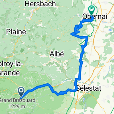
 Sainte-Marie-aux-Mines to Obernai 60km
- Distance
- 59.3 km
- Ascent
- 992 m
- Descent
- 1,203 m
- Location
- Sainte-Marie-aux-Mines, Grand Est, France
 Alternative 3ème étape Crête des Vosges
- Distance
- 77.6 km
- Ascent
- 1,098 m
- Descent
- 1,271 m
- Location
- Sainte-Marie-aux-Mines, Grand Est, France
 Vosges 17/07/2009
- Distance
- 144.5 km
- Ascent
- 2,949 m
- Descent
- 3,044 m
- Location
- Sainte-Marie-aux-Mines, Grand Est, France
 Sainte-Marie-aux-Mines nach Lahr
- Distance
- 68.7 km
- Ascent
- 36 m
- Descent
- 237 m
- Location
- Sainte-Marie-aux-Mines, Grand Est, France
 Munster to Sainte-Marie-aux-Mines 48km
- Distance
- 47.9 km
- Ascent
- 1,680 m
- Descent
- 1,688 m
- Location
- Sainte-Marie-aux-Mines, Grand Est, France
 2022.5 Ste Marie aux Mines - Andlau
- Distance
- 98.4 km
- Ascent
- 1,938 m
- Descent
- 2,228 m
- Location
- Sainte-Marie-aux-Mines, Grand Est, France
 3 Etape Vogesen
- Distance
- 140.3 km
- Ascent
- 1,821 m
- Descent
- 2,029 m
- Location
- Sainte-Marie-aux-Mines, Grand Est, France
 Sainte-Marie-aux-Mines to Obernai 73km
- Distance
- 73.6 km
- Ascent
- 1,667 m
- Descent
- 1,881 m
- Location
- Sainte-Marie-aux-Mines, Grand Est, France
Open it in the app