

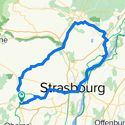
Overview
About this route
- -:--
- Duration
- 74.7 km
- Distance
- 1,445 m
- Ascent
- 1,444 m
- Descent
- ---
- Avg. speed
- 783 m
- Max. altitude

Part of
Alsace
12 stages
Route quality
Waytypes & surfaces along the route
Waytypes
Cycleway
17.2 km
(23 %)
Quiet road
13.5 km
(18 %)
Surfaces
Paved
39.6 km
(53 %)
Unpaved
6.7 km
(9 %)
Asphalt
38.9 km
(52 %)
Unpaved (undefined)
2.2 km
(3 %)
Route highlights
Points of interest along the route
Point of interest after 24 km
Charge
Point of interest after 60 km
Charge
Continue with Bikemap
Use, edit, or download this cycling route
You would like to ride Mont Saint Odile (chemins) - Tour or customize it for your own trip? Here is what you can do with this Bikemap route:
Free features
- Save this route as favorite or in collections
- Copy & plan your own version of this route
- Sync your route with Garmin or Wahoo
Premium features
Free trial for 3 days, or one-time payment. More about Bikemap Premium.
- Navigate this route on iOS & Android
- Export a GPX / KML file of this route
- Create your custom printout (try it for free)
- Download this route for offline navigation
Discover more Premium features.
Get Bikemap PremiumFrom our community
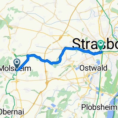
Other popular routes starting in Molsheim
 Molsheim 55km - Autour (route)
- Distance
- 55.3 km
- Ascent
- 577 m
- Descent
- 577 m
- Location
- Molsheim, Grand Est, France
 Mont Saint Odile (chemins) - Tour
- Distance
- 74.7 km
- Ascent
- 1,445 m
- Descent
- 1,444 m
- Location
- Molsheim, Grand Est, France
 140729, 8. Etappe, Molsheim-Sarrebourg
- Distance
- 80.2 km
- Ascent
- 745 m
- Descent
- 664 m
- Location
- Molsheim, Grand Est, France
 Haguenau
- Distance
- 112.7 km
- Ascent
- 605 m
- Descent
- 604 m
- Location
- Molsheim, Grand Est, France
 Feg-Molsheim Gare-Birkenwald
- Distance
- 69.3 km
- Ascent
- 184 m
- Descent
- 211 m
- Location
- Molsheim, Grand Est, France
 piste cyclable
- Distance
- 23 km
- Ascent
- 249 m
- Descent
- 303 m
- Location
- Molsheim, Grand Est, France
 Molsheim Gare -Fegersheim Aller-Retour
- Distance
- 34 km
- Ascent
- 35 m
- Descent
- 49 m
- Location
- Molsheim, Grand Est, France
 Mont Saint Odile (route) - Tour
- Distance
- 84.7 km
- Ascent
- 1,547 m
- Descent
- 1,544 m
- Location
- Molsheim, Grand Est, France
Open it in the app