

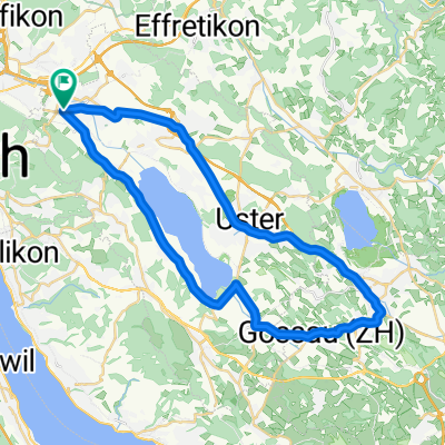
Route 3
A cycling route starting in Dübendorf / Wasserfurren, Canton of Zurich, Switzerland.
Overview
About this route
- -:--
- Duration
- 40.1 km
- Distance
- 192 m
- Ascent
- 190 m
- Descent
- ---
- Avg. speed
- ---
- Max. altitude
Route quality
Waytypes & surfaces along the route
Waytypes
Path
18.1 km
(45 %)
Road
8.4 km
(21 %)
Surfaces
Paved
40.1 km
(100 %)
Asphalt
39.7 km
(99 %)
Concrete
0.4 km
(1 %)
Continue with Bikemap
Use, edit, or download this cycling route
You would like to ride Route 3 or customize it for your own trip? Here is what you can do with this Bikemap route:
Free features
- Save this route as favorite or in collections
- Copy & plan your own version of this route
- Sync your route with Garmin or Wahoo
Premium features
Free trial for 3 days, or one-time payment. More about Bikemap Premium.
- Navigate this route on iOS & Android
- Export a GPX / KML file of this route
- Create your custom printout (try it for free)
- Download this route for offline navigation
Discover more Premium features.
Get Bikemap PremiumFrom our community
Other popular routes starting in Dübendorf / Wasserfurren
 Route 3
- Distance
- 40.1 km
- Ascent
- 192 m
- Descent
- 190 m
- Location
- Dübendorf / Wasserfurren, Canton of Zurich, Switzerland
 Dübendorf / 2x Greifensee
- Distance
- 50.5 km
- Ascent
- 228 m
- Descent
- 234 m
- Location
- Dübendorf / Wasserfurren, Canton of Zurich, Switzerland
 zh-mendrisio
- Distance
- 272.8 km
- Ascent
- 0 m
- Descent
- 0 m
- Location
- Dübendorf / Wasserfurren, Canton of Zurich, Switzerland
 Zürich Stettbach - Rheinsfelden - Badi Kaiserstuhl CLONED FROM ROUTE 286966
- Distance
- 36.4 km
- Ascent
- 96 m
- Descent
- 189 m
- Location
- Dübendorf / Wasserfurren, Canton of Zurich, Switzerland
 Hochbordstrasse-Schwamendingen-Zoo
- Distance
- 11.2 km
- Ascent
- 288 m
- Descent
- 274 m
- Location
- Dübendorf / Wasserfurren, Canton of Zurich, Switzerland
 Steady ride in Dübendorf
- Distance
- 12.1 km
- Ascent
- 289 m
- Descent
- 293 m
- Location
- Dübendorf / Wasserfurren, Canton of Zurich, Switzerland
 Dübi Rappi
- Distance
- 33.3 km
- Ascent
- 225 m
- Descent
- 245 m
- Location
- Dübendorf / Wasserfurren, Canton of Zurich, Switzerland
 rapperswill
- Distance
- 32.8 km
- Ascent
- 393 m
- Descent
- 416 m
- Location
- Dübendorf / Wasserfurren, Canton of Zurich, Switzerland
Open it in the app