

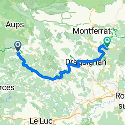
Cours Théodore Bouge, Salernes à Route Departementale, Callas
- 42.7 km
- 840 m
- 766 m
- Salernes, Provence-Alpes-Côte d'Azur Region, France
A cycling route starting in Salernes, Provence-Alpes-Côte d'Azur Region, France.
Overview
This route goes north to Salernes, and around the village, up to the Sillians de la Cascade. That's about a 5 KM climb from Salernes to the falls, and then another 30 meters until it is all downhill to Carces, through Contignac. Then follow the D562 to the D31 back to Entrecasteaux. About 25 miles, and it can be done in about 1:30.
created this 14 years ago
Route quality
Road
13.1 km
(32 %)
Quiet road
0.4 km
(1 %)
Paved
20 km
(49 %)
Asphalt
20 km
(49 %)
Undefined
20.9 km
(51 %)
Route highlights
Fun and Quick
Continue with Bikemap
You would like to ride Fun & Quick or customize it for your own trip? Here is what you can do with this Bikemap route:
Free trial for 3 days, or one-time payment. More about Bikemap Premium.
Discover more Premium features.
Get Bikemap PremiumFrom our community
Open it in the app


