
Lewisburg, Blue Sulphur Springs - Option B - Lewisburg, Blue Sulphur Springs - Option B
A cycling route starting in Lewisburg, West Virginia, United States.
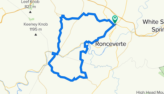
Overview
About this route
A beautiful and challenging route in southern Greenbrier and northern Monoe Counties. Alderson is the one place for mid-ride replenishment of water and food. A two mile detour takes you to the site of the former Blue Sulphur Springs resort. The remaining pravilion provides a great photo opportunity. General Lee's war horse Traveller was raised in the area of Blue Sulphur. - A beautiful and challenging route in southern Greenbrier and northern Monoe Counties. Alderson is the one place for mid-ride replenishment of water and food. A two mile detour takes you to the site of the former Blue Sulphur Springs resort. The remaining pravilion provides a great photo opportunity. General Lee's war horse Traveller was raised in the area of Blue Sulphur.
- -:--
- Duration
- 80 km
- Distance
- 1,912 m
- Ascent
- 1,915 m
- Descent
- ---
- Avg. speed
- 795 m
- Max. altitude

Route quality
Waytypes & surfaces along the route
Waytypes
Quiet road
31.2 km
(39 %)
Road
25.6 km
(32 %)
Undefined
23.2 km
(29 %)
Surfaces
Paved
7.2 km
(9 %)
Paved (undefined)
4 km
(5 %)
Asphalt
3.2 km
(4 %)
Undefined
72.8 km
(91 %)
Continue with Bikemap
Use, edit, or download this cycling route
You would like to ride Lewisburg, Blue Sulphur Springs - Option B - Lewisburg, Blue Sulphur Springs - Option B or customize it for your own trip? Here is what you can do with this Bikemap route:
Free features
- Save this route as favorite or in collections
- Copy & plan your own version of this route
- Sync your route with Garmin or Wahoo
Premium features
Free trial for 3 days, or one-time payment. More about Bikemap Premium.
- Navigate this route on iOS & Android
- Export a GPX / KML file of this route
- Create your custom printout (try it for free)
- Download this route for offline navigation
Discover more Premium features.
Get Bikemap PremiumFrom our community
Other popular routes starting in Lewisburg
 Williamsburg Loop
- Distance
- 76.8 km
- Ascent
- 636 m
- Descent
- 636 m
- Location
- Lewisburg, West Virginia, United States
 ms150?
- Distance
- 114.4 km
- Ascent
- 1,535 m
- Descent
- 1,461 m
- Location
- Lewisburg, West Virginia, United States
 Unis Loop
- Distance
- 62.3 km
- Ascent
- 630 m
- Descent
- 630 m
- Location
- Lewisburg, West Virginia, United States
 Lewisburg, Blue Sulphur Springs - Option B - Lewisburg, Blue Sulphur Springs - Option B
- Distance
- 80 km
- Ascent
- 1,912 m
- Descent
- 1,915 m
- Location
- Lewisburg, West Virginia, United States
 Lewisburg, Blue Sulphur Springs - Option B
- Distance
- 79 km
- Ascent
- 905 m
- Descent
- 905 m
- Location
- Lewisburg, West Virginia, United States
 Greenbrier River Trail, Caldwell - Lewisburg
- Distance
- 6.6 km
- Ascent
- 67 m
- Descent
- 52 m
- Location
- Lewisburg, West Virginia, United States
 Unis Loop 1
- Distance
- 57.9 km
- Ascent
- 373 m
- Descent
- 373 m
- Location
- Lewisburg, West Virginia, United States
 219route
- Distance
- 97.3 km
- Ascent
- 1,127 m
- Descent
- 906 m
- Location
- Lewisburg, West Virginia, United States
Open it in the app