

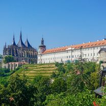
VIII TRR, TG - Kutna Hora/Praha
Etap 7A, Zdar nad Sazavou - Kutna Hora
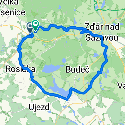
A cycling route starting in Zdar, Kraj Vysočina, Czechia.
Overview
About this route
Alternative route plan
- -:--
- Duration
- 87.9 km
- Distance
- 689 m
- Ascent
- 1,012 m
- Descent
- ---
- Avg. speed
- 658 m
- Max. altitude

Part of
VIII TRR, TG - Kutna Hora/Praha
11 stages
Route quality
Waytypes & surfaces along the route
Waytypes
Road
43.9 km
(50 %)
Quiet road
12.3 km
(14 %)
Surfaces
Paved
32.5 km
(37 %)
Unpaved
3.5 km
(4 %)
Asphalt
29.9 km
(34 %)
Paved (undefined)
2.6 km
(3 %)
Continue with Bikemap
Use, edit, or download this cycling route
You would like to ride Etap 7A, Zdar nad Sazavou - Kutna Hora or customize it for your own trip? Here is what you can do with this Bikemap route:
Free features
- Save this route as favorite or in collections
- Copy & plan your own version of this route
- Split it into stages to create a multi-day tour
- Sync your route with Garmin or Wahoo
Premium features
Free trial for 3 days, or one-time payment. More about Bikemap Premium.
- Navigate this route on iOS & Android
- Export a GPX / KML file of this route
- Create your custom printout (try it for free)
- Download this route for offline navigation
Discover more Premium features.
Get Bikemap PremiumFrom our community
Other popular routes starting in Zdar
 Ze Žďáru okolo Sázavy, do Přibyslavi a přes Polnou zpět
- Distance
- 68.2 km
- Ascent
- 528 m
- Descent
- 529 m
- Location
- Zdar, Kraj Vysočina, Czechia
 sustr cup
- Distance
- 35.5 km
- Ascent
- 574 m
- Descent
- 404 m
- Location
- Zdar, Kraj Vysočina, Czechia
 Red-Bull - Vodka tour, swih 3
- Distance
- 22.4 km
- Ascent
- 253 m
- Descent
- 250 m
- Location
- Zdar, Kraj Vysočina, Czechia
 Sazava, Nove Veseli, Zdar nad Sazavou, Sazava
- Distance
- 25 km
- Ascent
- 305 m
- Descent
- 286 m
- Location
- Zdar, Kraj Vysočina, Czechia
 Na rendlik
- Distance
- 28.1 km
- Ascent
- 221 m
- Descent
- 220 m
- Location
- Zdar, Kraj Vysočina, Czechia
 Red-Bull - Vodka tour, swih 2
- Distance
- 87 km
- Ascent
- 644 m
- Descent
- 650 m
- Location
- Zdar, Kraj Vysočina, Czechia
 Prague - Brno, Euro Velo No 7, 13, 9 and 4! Etapp 6
- Distance
- 139.8 km
- Ascent
- 1,444 m
- Descent
- 1,838 m
- Location
- Zdar, Kraj Vysočina, Czechia
 Trénink na zítřek
- Distance
- 44.8 km
- Ascent
- 455 m
- Descent
- 451 m
- Location
- Zdar, Kraj Vysočina, Czechia
Open it in the app