

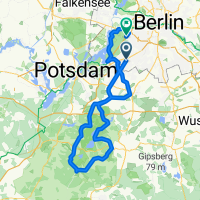
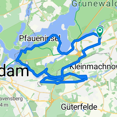
Flache Cross-Runde Berlin-Südwest
A cycling route starting in Zehlendorf, State of Berlin, Germany.
Overview
About this route
Hier mal eine ganz nette Tour fürs Crossrad oder MTB. Die Wege sind teils breit (auch ein wenig auf der Straße bzw. Fahrradweg), aber gerade am Teltow-Kanal oder in Kleinmachnow auch single trails. Es geht unter anderem vorbei an der Pfaueninsel, Glienicker Brücke, Griebnitzsee, Teltow-Kanal, versteckte Wege in Kleinmachnow an der Schleuse, Südwest Friedhof Stahnsdorf, dnn wieder zurück zum alten Kontrollpunkt Dreilinden und über das alte Stück Autobahn nach Zehlendorf.
- -:--
- Duration
- 42.1 km
- Distance
- 114 m
- Ascent
- 111 m
- Descent
- ---
- Avg. speed
- ---
- Max. altitude
Continue with Bikemap
Use, edit, or download this cycling route
You would like to ride Flache Cross-Runde Berlin-Südwest or customize it for your own trip? Here is what you can do with this Bikemap route:
Free features
- Save this route as favorite or in collections
- Copy & plan your own version of this route
- Sync your route with Garmin or Wahoo
Premium features
Free trial for 3 days, or one-time payment. More about Bikemap Premium.
- Navigate this route on iOS & Android
- Export a GPX / KML file of this route
- Create your custom printout (try it for free)
- Download this route for offline navigation
Discover more Premium features.
Get Bikemap PremiumFrom our community
Other popular routes starting in Zehlendorf
 Zehlendorf -> Trebbin
- Distance
- 72.6 km
- Ascent
- 96 m
- Descent
- 95 m
- Location
- Zehlendorf, State of Berlin, Germany
 RTF 24. Eichh. 2. Runde
- Distance
- 40.5 km
- Ascent
- 112 m
- Descent
- 116 m
- Location
- Zehlendorf, State of Berlin, Germany
 Radtour Südlich von Berlin
- Distance
- 68.2 km
- Ascent
- 117 m
- Descent
- 117 m
- Location
- Zehlendorf, State of Berlin, Germany
 Dobbrikow andersrum
- Distance
- 111.2 km
- Ascent
- 139 m
- Descent
- 133 m
- Location
- Zehlendorf, State of Berlin, Germany
 S Zehlendorf -> Tremsdorf -> Caputh -> Auerbachtunnel
- Distance
- 65.4 km
- Ascent
- 258 m
- Descent
- 245 m
- Location
- Zehlendorf, State of Berlin, Germany
 Flache Cross-Runde Berlin-Südwest
- Distance
- 42.1 km
- Ascent
- 114 m
- Descent
- 111 m
- Location
- Zehlendorf, State of Berlin, Germany
 Dahlem Route
- Distance
- 15.8 km
- Ascent
- 49 m
- Descent
- 52 m
- Location
- Zehlendorf, State of Berlin, Germany
 Zehlendorf -> Fresdorf -> Caputh -> Teufelsberg
- Distance
- 85.4 km
- Ascent
- 298 m
- Descent
- 287 m
- Location
- Zehlendorf, State of Berlin, Germany
Open it in the app