
Caminhada lenta 🙏😎
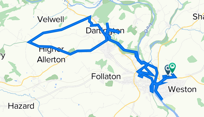
A cycling route starting in Totnes, England, United Kingdom.
Overview
About this route
- 1 h 53 min
- Duration
- 23.8 km
- Distance
- 632 m
- Ascent
- 689 m
- Descent
- 12.6 km/h
- Avg. speed
- 182 m
- Max. altitude

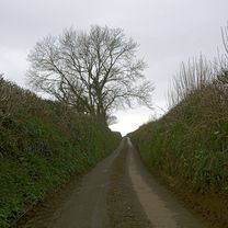
Route photos

Continue with Bikemap
Use, edit, or download this cycling route
You would like to ride Caminhada lenta 🙏😎 or customize it for your own trip? Here is what you can do with this Bikemap route:
Free features
- Save this route as favorite or in collections
- Copy & plan your own version of this route
- Sync your route with Garmin or Wahoo
Premium features
Free trial for 3 days, or one-time payment. More about Bikemap Premium.
- Navigate this route on iOS & Android
- Export a GPX / KML file of this route
- Create your custom printout (try it for free)
- Download this route for offline navigation
Discover more Premium features.
Get Bikemap PremiumFrom our community
Other popular routes starting in Totnes
 De Totnes a Totnes
- Distance
- 17.3 km
- Ascent
- 379 m
- Descent
- 385 m
- Location
- Totnes, England, United Kingdom
 Staverton area
- Distance
- 34.4 km
- Ascent
- 324 m
- Descent
- 319 m
- Location
- Totnes, England, United Kingdom
 Bridgetown to Staverton
- Distance
- 8.1 km
- Ascent
- 101 m
- Descent
- 140 m
- Location
- Totnes, England, United Kingdom
 Caminhada lenta 🙏😎
- Distance
- 23.8 km
- Ascent
- 632 m
- Descent
- 689 m
- Location
- Totnes, England, United Kingdom
 eMTB off and on Road trail
- Distance
- 26.7 km
- Ascent
- 106 m
- Descent
- 211 m
- Location
- Totnes, England, United Kingdom
 Avon dam
- Distance
- 21 km
- Ascent
- 0 m
- Descent
- 23 m
- Location
- Totnes, England, United Kingdom
 Thigh burning scenic route of South Devon
- Distance
- 68.5 km
- Ascent
- 1,149 m
- Descent
- 1,149 m
- Location
- Totnes, England, United Kingdom
 Saturday loop
- Distance
- 23.4 km
- Ascent
- 445 m
- Descent
- 470 m
- Location
- Totnes, England, United Kingdom
Open it in the app