

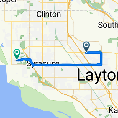
2485 N 1100 W, Layton to 1437–1457 S 400 W, Salt Lake City
A cycling route starting in Hill Air Force Base, Utah, United States.
Overview
About this route
- 2 h 36 min
- Duration
- 44.9 km
- Distance
- 80 m
- Ascent
- 179 m
- Descent
- 17.2 km/h
- Avg. speed
- 1,393 m
- Max. altitude
Route quality
Waytypes & surfaces along the route
Waytypes
Road
15.7 km
(35 %)
Cycleway
13 km
(29 %)
Surfaces
Paved
36.4 km
(81 %)
Asphalt
35 km
(78 %)
Concrete
1.3 km
(3 %)
Undefined
8.5 km
(19 %)
Continue with Bikemap
Use, edit, or download this cycling route
You would like to ride 2485 N 1100 W, Layton to 1437–1457 S 400 W, Salt Lake City or customize it for your own trip? Here is what you can do with this Bikemap route:
Free features
- Save this route as favorite or in collections
- Copy & plan your own version of this route
- Sync your route with Garmin or Wahoo
Premium features
Free trial for 3 days, or one-time payment. More about Bikemap Premium.
- Navigate this route on iOS & Android
- Export a GPX / KML file of this route
- Create your custom printout (try it for free)
- Download this route for offline navigation
Discover more Premium features.
Get Bikemap PremiumFrom our community
Other popular routes starting in Hill Air Force Base
 2426 N 75 E, Layton to 2426 N 75 E, Layton
- Distance
- 17.7 km
- Ascent
- 96 m
- Descent
- 97 m
- Location
- Hill Air Force Base, Utah, United States
 2426 N 75 E, Layton to 191–205 N West Promontory, Farmington
- Distance
- 16.4 km
- Ascent
- 10 m
- Descent
- 127 m
- Location
- Hill Air Force Base, Utah, United States
 home to 21st st pond
- Distance
- 25.2 km
- Ascent
- 104 m
- Descent
- 170 m
- Location
- Hill Air Force Base, Utah, United States
 2485 N 1100 W, Layton to 1437–1457 S 400 W, Salt Lake City
- Distance
- 44.9 km
- Ascent
- 80 m
- Descent
- 179 m
- Location
- Hill Air Force Base, Utah, United States
 2426 N 75 E, Layton to 2402 N 75 E, Layton
- Distance
- 2.9 km
- Ascent
- 35 m
- Descent
- 37 m
- Location
- Hill Air Force Base, Utah, United States
 Recovered Route
- Distance
- 1 km
- Ascent
- 22 m
- Descent
- 3 m
- Location
- Hill Air Force Base, Utah, United States
 E 700 S, Clearfield to S 4100 W Cir, Syracuse
- Distance
- 15.7 km
- Ascent
- 60 m
- Descent
- 167 m
- Location
- Hill Air Force Base, Utah, United States
 New Beginnings
- Distance
- 15 km
- Ascent
- 212 m
- Descent
- 212 m
- Location
- Hill Air Force Base, Utah, United States
Open it in the app