
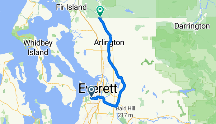
Everett to Skagit County Line via Centennial Trail
A cycling route starting in Mukilteo, Washington, United States.
Overview
About this route
Also utilizes a portion of the Interurban Trail in Everett. New connector between 204th and Downtown Arlington scheduled for completion 2013. Beware Centennial Trail congestion on weekends with nice weather. Only big hill is from Everett to Snohomish River Valley.
- -:--
- Duration
- 64.8 km
- Distance
- 248 m
- Ascent
- 294 m
- Descent
- ---
- Avg. speed
- ---
- Max. altitude

Route quality
Waytypes & surfaces along the route
Waytypes
Cycleway
40.2 km
(62 %)
Road
12.3 km
(19 %)
Surfaces
Paved
51.8 km
(80 %)
Asphalt
51.8 km
(80 %)
Undefined
13 km
(20 %)
Continue with Bikemap
Use, edit, or download this cycling route
You would like to ride Everett to Skagit County Line via Centennial Trail or customize it for your own trip? Here is what you can do with this Bikemap route:
Free features
- Save this route as favorite or in collections
- Copy & plan your own version of this route
- Sync your route with Garmin or Wahoo
Premium features
Free trial for 3 days, or one-time payment. More about Bikemap Premium.
- Navigate this route on iOS & Android
- Export a GPX / KML file of this route
- Create your custom printout (try it for free)
- Download this route for offline navigation
Discover more Premium features.
Get Bikemap PremiumFrom our community
Other popular routes starting in Mukilteo
 Relaxed route in Mukilteo
- Distance
- 5.7 km
- Ascent
- 218 m
- Descent
- 215 m
- Location
- Mukilteo, Washington, United States
 try this
- Distance
- 38.3 km
- Ascent
- 234 m
- Descent
- 284 m
- Location
- Mukilteo, Washington, United States
 Everett-Maple Valley 4 Trails
- Distance
- 174.4 km
- Ascent
- 458 m
- Descent
- 458 m
- Location
- Mukilteo, Washington, United States
 Everett-LaConner-Whidbey Loop
- Distance
- 195.7 km
- Ascent
- 727 m
- Descent
- 726 m
- Location
- Mukilteo, Washington, United States
 Everett to LaConner
- Distance
- 81.2 km
- Ascent
- 200 m
- Descent
- 318 m
- Location
- Mukilteo, Washington, United States
 EI to Marymoor
- Distance
- 40 km
- Ascent
- 115 m
- Descent
- 272 m
- Location
- Mukilteo, Washington, United States
 Everett to Lk Washington Loop
- Distance
- 132.8 km
- Ascent
- 643 m
- Descent
- 643 m
- Location
- Mukilteo, Washington, United States
 Everett to Skagit County Line via Centennial Trail
- Distance
- 64.8 km
- Ascent
- 248 m
- Descent
- 294 m
- Location
- Mukilteo, Washington, United States
Open it in the app