09136-1439-Lyon-Francheville-Thurins-Yzeron-Duerne-StMartinEnHaut-LAubepin-StChristoEnJarez-StHeand-Veauche
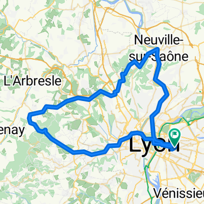
A cycling route starting in Villeurbanne, Auvergne-Rh么ne-Alpes, France.
Overview
About this route
09136-1439-Lyon-Francheville-Thurins-Yzeron-Duerne-StMartinEnHaut-LAubepin-StChristoEnJarez-StHeand-Veauche
- -:--
- Duration
- 87.9 km
- Distance
- 1,613 m
- Ascent
- 1,367 m
- Descent
- ---
- Avg. speed
- 902 m
- Avg. speed
Route quality
Waytypes & surfaces along the route
Waytypes
Busy road
46.7 km
(53 %)
Road
27.4 km
(31 %)
Surfaces
Paved
50.8 km
(58 %)
Asphalt
50.2 km
(57 %)
Concrete
0.3 km
(<1 %)
Continue with Bikemap
Use, edit, or download this cycling route
You would like to ride 09136-1439-Lyon-Francheville-Thurins-Yzeron-Duerne-StMartinEnHaut-LAubepin-StChristoEnJarez-StHeand-Veauche or customize it for your own trip? Here is what you can do with this Bikemap route:
Free features
- Save this route as favorite or in collections
- Copy & plan your own version of this route
- Sync your route with Garmin or Wahoo
Premium features
Free trial for 3 days, or one-time payment. More about Bikemap Premium.
- Navigate this route on iOS & Android
- Export a GPX / KML file of this route
- Create your custom printout (try it for free)
- Download this route for offline navigation
Discover more Premium features.
Get Bikemap PremiumFrom our community
Other popular routes starting in Villeurbanne
- Lyon Kurztrip mit Berg
- Distance
- 32.1 km
- Ascent
- 213 m
- Descent
- 215 m
- Location
- Villeurbanne, Auvergne-Rh么ne-Alpes, France
- Monts d'or 1
- Distance
- 59.7 km
- Ascent
- 1,074 m
- Descent
- 1,073 m
- Location
- Villeurbanne, Auvergne-Rh么ne-Alpes, France
- Lac des Eaux Bleues
- Distance
- 22.8 km
- Ascent
- 74 m
- Descent
- 73 m
- Location
- Villeurbanne, Auvergne-Rh么ne-Alpes, France
- Rue Marie Antoinette to Rue Br没l茅e
- Distance
- 32.3 km
- Ascent
- 157 m
- Descent
- 149 m
- Location
- Villeurbanne, Auvergne-Rh么ne-Alpes, France
- Aux portes de Lyon 2
- Distance
- 80.8 km
- Ascent
- 665 m
- Descent
- 660 m
- Location
- Villeurbanne, Auvergne-Rh么ne-Alpes, France
- Charpennes - Mont Verdun
- Distance
- 39.5 km
- Ascent
- 880 m
- Descent
- 879 m
- Location
- Villeurbanne, Auvergne-Rh么ne-Alpes, France
- Monts d'or 3
- Distance
- 62.7 km
- Ascent
- 843 m
- Descent
- 843 m
- Location
- Villeurbanne, Auvergne-Rh么ne-Alpes, France
- Vitesse supersonique en
- Distance
- 17.7 km
- Ascent
- 57 m
- Descent
- 71 m
- Location
- Villeurbanne, Auvergne-Rh么ne-Alpes, France
Open it in the app