


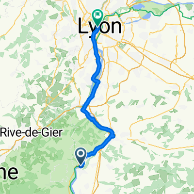
05777-1107-Condrieu-Chavanay-Pelussin-Doizieux-Chuyer-Condrieu
A cycling route starting in Condrieu, Auvergne-Rhône-Alpes, France.
Overview
About this route
1
05777-1107-Condrieu-Chavanay-Pelussin-Doizieux-Chuyer-Condrieu
- -:--
- Duration
- 55.2 km
- Distance
- 1,496 m
- Ascent
- 1,212 m
- Descent
- ---
- Avg. speed
- 1,064 m
- Max. altitude
Syl20
created this 17 years ago
Route quality
Waytypes & surfaces along the route
Waytypes
Road
9.4 km
17 %
Quiet road
4.4 km
8 %
Surfaces
Paved
44.1 km
(80 %)
Unpaved
1.1 km
(2 %)
Asphalt
44.1 km
80 %
Gravel
0.6 km
1 %
Continue with Bikemap
Use, edit, or download this cycling route
You would like to ride 05777-1107-Condrieu-Chavanay-Pelussin-Doizieux-Chuyer-Condrieu or customize it for your own trip? Here is what you can do with this Bikemap route:
Free features
- Save this route as favorite or in collections
- Copy & plan your own version of this route
- Sync your route with Garmin or Wahoo
Premium features
Free trial for 3 days, or one-time payment. More about Bikemap Premium.
- Navigate this route on iOS & Android
- Export a GPX / KML file of this route
- Create your custom printout (try it for free)
- Download this route for offline navigation
Discover more Premium features.
Get Bikemap PremiumFrom our community
Other popular routes starting in Condrieu


 Etape 14 - Condrieu à Montmerle sur Saône - 89,8km 120D+0
- 89.8 km
- 145 m
- 119 m
- Condrieu, Auvergne-Rhône-Alpes, France


Open it in the app