![Mogilany - Zawoja - Mogilany [134km]](/_next/static/media/contour-lines-light-small.cafd5e5d.avif)
![Mogilany - Zawoja - Mogilany [134km]](https://media.bikemap.net/routes/1065708/staticmaps/in_477824de-d2e7-43a8-a790-8cff411f51aa_694x400_bikemap-2021-3D-static.png)
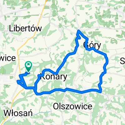
Mogilany - Zawoja - Mogilany [134km]
A cycling route starting in Mogilany, Lesser Poland Voivodeship, Poland.
Overview
About this route
Czerwiec 2011 - od ronda w Zawoji do Wyciągu - nawierzchnia ściagnięta, nie wyrównana - tragedia dla szosówki.
- -:--
- Duration
- 69.8 km
- Distance
- 586 m
- Ascent
- 296 m
- Descent
- ---
- Avg. speed
- ---
- Max. altitude
Route quality
Waytypes & surfaces along the route
Waytypes
Busy road
41.4 km
(59 %)
Quiet road
11.6 km
(17 %)
Surfaces
Paved
51.8 km
(74 %)
Unpaved
0.7 km
(1 %)
Asphalt
47.6 km
(68 %)
Paving stones
4.1 km
(6 %)
Continue with Bikemap
Use, edit, or download this cycling route
You would like to ride Mogilany - Zawoja - Mogilany [134km] or customize it for your own trip? Here is what you can do with this Bikemap route:
Free features
- Save this route as favorite or in collections
- Copy & plan your own version of this route
- Sync your route with Garmin or Wahoo
Premium features
Free trial for 3 days, or one-time payment. More about Bikemap Premium.
- Navigate this route on iOS & Android
- Export a GPX / KML file of this route
- Create your custom printout (try it for free)
- Download this route for offline navigation
Discover more Premium features.
Get Bikemap PremiumFrom our community
Other popular routes starting in Mogilany
 Trening
- Distance
- 22.7 km
- Ascent
- 350 m
- Descent
- 350 m
- Location
- Mogilany, Lesser Poland Voivodeship, Poland
 Mogilany-Myślenice-Zawada-Olszowice-Konary-Gorzków-Mogilany
- Distance
- 50 km
- Ascent
- 465 m
- Descent
- 465 m
- Location
- Mogilany, Lesser Poland Voivodeship, Poland
 zjezd bronaczow
- Distance
- 9 km
- Ascent
- 113 m
- Descent
- 254 m
- Location
- Mogilany, Lesser Poland Voivodeship, Poland
 Czarny las
- Distance
- 23.6 km
- Ascent
- 365 m
- Descent
- 361 m
- Location
- Mogilany, Lesser Poland Voivodeship, Poland
 Petla Wlosan
- Distance
- 18.7 km
- Ascent
- 448 m
- Descent
- 448 m
- Location
- Mogilany, Lesser Poland Voivodeship, Poland
 Dobczyce-Iwowa-Proszwicek
- Distance
- 268.6 km
- Ascent
- 890 m
- Descent
- 1,028 m
- Location
- Mogilany, Lesser Poland Voivodeship, Poland
 RezGoscibaSh
- Distance
- 57.7 km
- Ascent
- 1,391 m
- Descent
- 1,391 m
- Location
- Mogilany, Lesser Poland Voivodeship, Poland
 Gorce
Gorce- Distance
- 161.4 km
- Ascent
- 1,560 m
- Descent
- 1,561 m
- Location
- Mogilany, Lesser Poland Voivodeship, Poland
Open it in the app