

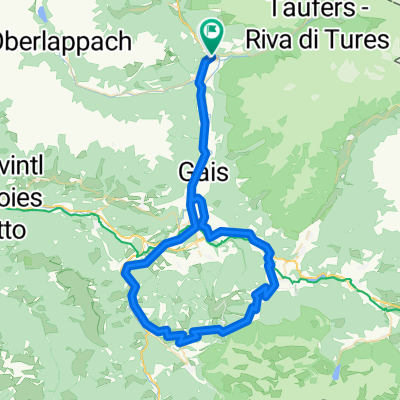
Sand-Lappach-ChemnitzerHütte-Weißenbach-Sand
A cycling route starting in Sand in Taufers, Trentino-Alto Adige, Italy.
Overview
About this route
Gesamtlänge: ca. 45 km
Gesamthöhe: ca. 1.600 Höhenmeter
Höchster Punkt: Chemnitzer Hütte 2.420 Meter
Leicht ansteigend die ersten 15 km von Sand in Taufers über Mühlen und Mühlwald bis kurz vor Lappach.
Ab dort zunehmend steiler bis zum Neves Stausee und Talschluss.
Ab nördlichem Ende des Stausees geht es Steil auf teilwiese schwierigem Gelände die letzten 600 Höhenmeter (ca. 4 km) bis zur Chemnitzer Hütte.
Von dort aus kann man nach einer Stärkung wahlweise auf dem selben Weg oder wie in dieser Route beschrieben über die Göge-Alm, Weißenbach und Luttach zurück nach Sand in Taufers fahren (bei dieser Variante gibt es kurze Schiebe/Tragepassagen).
Dieselbe Route lässt sich auch im Gegenuhrzeigersinn fahren, ist dort vom Gelände jedoch etwas anspruchsvoller!
- -:--
- Duration
- 43.4 km
- Distance
- 1,499 m
- Ascent
- 1,501 m
- Descent
- ---
- Avg. speed
- ---
- Max. altitude
Continue with Bikemap
Use, edit, or download this cycling route
You would like to ride Sand-Lappach-ChemnitzerHütte-Weißenbach-Sand or customize it for your own trip? Here is what you can do with this Bikemap route:
Free features
- Save this route as favorite or in collections
- Copy & plan your own version of this route
- Sync your route with Garmin or Wahoo
Premium features
Free trial for 3 days, or one-time payment. More about Bikemap Premium.
- Navigate this route on iOS & Android
- Export a GPX / KML file of this route
- Create your custom printout (try it for free)
- Download this route for offline navigation
Discover more Premium features.
Get Bikemap PremiumFrom our community
Other popular routes starting in Sand in Taufers
 Sand-MariaSaalen-St.Vigil-Furkelpass-Olang-Sand
- Distance
- 72.3 km
- Ascent
- 1,117 m
- Descent
- 1,117 m
- Location
- Sand in Taufers, Trentino-Alto Adige, Italy
 Anello Castello Tures - cascate Riva
- Distance
- 9 km
- Ascent
- 376 m
- Descent
- 375 m
- Location
- Sand in Taufers, Trentino-Alto Adige, Italy
 Via Unterpojen, Campo Tures to Bahnhofsplatz, Lienz
- Distance
- 101.7 km
- Ascent
- 1,516 m
- Descent
- 2,028 m
- Location
- Sand in Taufers, Trentino-Alto Adige, Italy
 Giro a velocità costante in Santo Stefano
- Distance
- 22.7 km
- Ascent
- 222 m
- Descent
- 150 m
- Location
- Sand in Taufers, Trentino-Alto Adige, Italy
 Sand-Luttach-Weissenbach-Großstahlhof
- Distance
- 20.4 km
- Ascent
- 474 m
- Descent
- 474 m
- Location
- Sand in Taufers, Trentino-Alto Adige, Italy
 Blossberg
- Distance
- 19.4 km
- Ascent
- 1,756 m
- Descent
- 73 m
- Location
- Sand in Taufers, Trentino-Alto Adige, Italy
 Klammljoch
- Distance
- 92.4 km
- Ascent
- 2,843 m
- Descent
- 2,842 m
- Location
- Sand in Taufers, Trentino-Alto Adige, Italy
 Sand in Taufers - Acereto
- Distance
- 6.8 km
- Ascent
- 477 m
- Descent
- 27 m
- Location
- Sand in Taufers, Trentino-Alto Adige, Italy
Open it in the app