
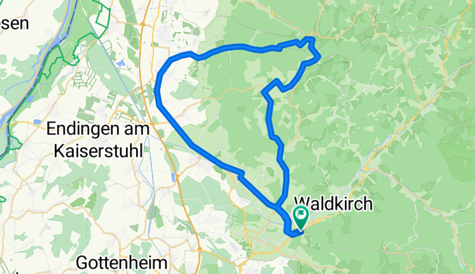
Suggental-Sexau-Ottoschwanden-Obersteig-Kenzingen-und zurück
A cycling route starting in Sexau, Baden-Wurttemberg, Germany.
Overview
About this route
Sehr schöne Schwarzwald Strecke. Einzig richtig steiler Anstieg zwischen Tennenbach und Mußbach. Danach angenehm. Von Obersteig bis Wagenstadt eine sagenhaft lange, steile und serpentinenreiche Abfahrt.
- -:--
- Duration
- 55.7 km
- Distance
- 405 m
- Ascent
- 444 m
- Descent
- ---
- Avg. speed
- 508 m
- Max. altitude

Route quality
Waytypes & surfaces along the route
Waytypes
Path
14.6 km
(26 %)
Quiet road
11.9 km
(21 %)
Surfaces
Paved
42.3 km
(76 %)
Unpaved
4 km
(7 %)
Asphalt
35.8 km
(64 %)
Paved (undefined)
4.8 km
(9 %)
Continue with Bikemap
Use, edit, or download this cycling route
You would like to ride Suggental-Sexau-Ottoschwanden-Obersteig-Kenzingen-und zurück or customize it for your own trip? Here is what you can do with this Bikemap route:
Free features
- Save this route as favorite or in collections
- Copy & plan your own version of this route
- Sync your route with Garmin or Wahoo
Premium features
Free trial for 3 days, or one-time payment. More about Bikemap Premium.
- Navigate this route on iOS & Android
- Export a GPX / KML file of this route
- Create your custom printout (try it for free)
- Download this route for offline navigation
Discover more Premium features.
Get Bikemap PremiumFrom our community
Other popular routes starting in Sexau
 1DE_Waldkirsch_Simonswald_St_Mergen_Glottertal
- Distance
- 63.5 km
- Ascent
- 709 m
- Descent
- 712 m
- Location
- Sexau, Baden-Wurttemberg, Germany
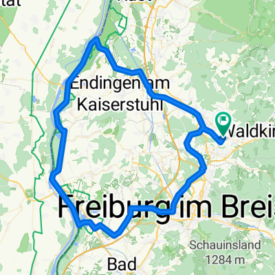 Rund um den Kaiserstuhl
- Distance
- 97.3 km
- Ascent
- 127 m
- Descent
- 127 m
- Location
- Sexau, Baden-Wurttemberg, Germany
 Waldkirch-Sexau-Tennenbach-Mußbach-Gscheid-Waldkirch
- Distance
- 35.4 km
- Ascent
- 496 m
- Descent
- 480 m
- Location
- Sexau, Baden-Wurttemberg, Germany
 Sexau-Kandelspitze
- Distance
- 16.5 km
- Ascent
- 1,102 m
- Descent
- 101 m
- Location
- Sexau, Baden-Wurttemberg, Germany
 Suggental-Sexau-Ottoschwanden-Obersteig-Kenzingen-und zurück
- Distance
- 55.7 km
- Ascent
- 405 m
- Descent
- 444 m
- Location
- Sexau, Baden-Wurttemberg, Germany
 Kandelrunde
- Distance
- 40 km
- Ascent
- 1,084 m
- Descent
- 1,086 m
- Location
- Sexau, Baden-Wurttemberg, Germany
 Schwarzwaldtour 2013 - Etappe3
- Distance
- 91.8 km
- Ascent
- 655 m
- Descent
- 653 m
- Location
- Sexau, Baden-Wurttemberg, Germany
 Teningen, Bahlingen, Eichstetten, Reute
- Distance
- 37.6 km
- Ascent
- 91 m
- Descent
- 93 m
- Location
- Sexau, Baden-Wurttemberg, Germany
Open it in the app