

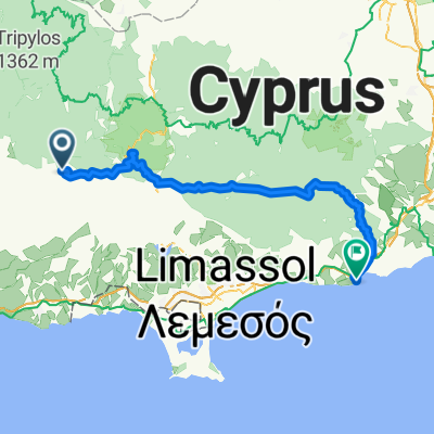
Arsos to Pano Platres
A cycling route starting in Páchna, Limassol District, Cyprus.
Overview
About this route
- -:--
- Duration
- 16.8 km
- Distance
- 808 m
- Ascent
- 513 m
- Descent
- ---
- Avg. speed
- 1,084 m
- Max. altitude

Route quality
Waytypes & surfaces along the route
Waytypes
Quiet road
6 km
(36 %)
Undefined
10.7 km
(64 %)
Surfaces
Paved
17 km
(101 %)
Asphalt
16.6 km
(99 %)
Paved (undefined)
0.2 km
(1 %)
Continue with Bikemap
Use, edit, or download this cycling route
You would like to ride Arsos to Pano Platres or customize it for your own trip? Here is what you can do with this Bikemap route:
Free features
- Save this route as favorite or in collections
- Copy & plan your own version of this route
- Sync your route with Garmin or Wahoo
Premium features
Free trial for 3 days, or one-time payment. More about Bikemap Premium.
- Navigate this route on iOS & Android
- Export a GPX / KML file of this route
- Create your custom printout (try it for free)
- Download this route for offline navigation
Discover more Premium features.
Get Bikemap PremiumFrom our community
Other popular routes starting in Páchna
 Kazani House Lofou to QQFQ+VVP
- Distance
- 16.3 km
- Ascent
- 355 m
- Descent
- 439 m
- Location
- Páchna, Limassol District, Cyprus
 Omodros to KK_e side
- Distance
- 35.6 km
- Ascent
- 991 m
- Descent
- 1,101 m
- Location
- Páchna, Limassol District, Cyprus
 Arsos to Pano Platres
- Distance
- 21.3 km
- Ascent
- 864 m
- Descent
- 546 m
- Location
- Páchna, Limassol District, Cyprus
 Tzelefos Kaminaria
- Distance
- 25.2 km
- Ascent
- 608 m
- Descent
- 608 m
- Location
- Páchna, Limassol District, Cyprus
 Cyprus Day 10.11
- Distance
- 91.8 km
- Ascent
- 1,509 m
- Descent
- 1,944 m
- Location
- Páchna, Limassol District, Cyprus
 tzelefos
- Distance
- 25.5 km
- Ascent
- 485 m
- Descent
- 485 m
- Location
- Páchna, Limassol District, Cyprus
 Arsos to Pano Platres
- Distance
- 16.8 km
- Ascent
- 808 m
- Descent
- 513 m
- Location
- Páchna, Limassol District, Cyprus
 Salamiou to Praitori
- Distance
- 13.1 km
- Ascent
- 538 m
- Descent
- 547 m
- Location
- Páchna, Limassol District, Cyprus
Open it in the app