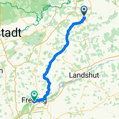
R4c: Unterlaichling-Mallersdorf, 16,1km, 150hm; xx:57 stdl
A cycling route starting in Schierling, Bavaria, Germany.
Overview
About this route
- -:--
- Duration
- 16.1 km
- Distance
- 197 m
- Ascent
- 193 m
- Descent
- ---
- Avg. speed
- 466 m
- Avg. speed
Route quality
Waytypes & surfaces along the route
Waytypes
Quiet road
5.6 km
(34 %)
Road
4.5 km
(28 %)
Surfaces
Paved
10.8 km
(67 %)
Asphalt
8.9 km
(55 %)
Paved (undefined)
1.9 km
(12 %)
Undefined
5.4 km
(33 %)
Continue with Bikemap
Use, edit, or download this cycling route
You would like to ride R4c: Unterlaichling-Mallersdorf, 16,1km, 150hm; xx:57 stdl or customize it for your own trip? Here is what you can do with this Bikemap route:
Free features
- Save this route as favorite or in collections
- Copy & plan your own version of this route
- Sync your route with Garmin or Wahoo
Premium features
Free trial for 3 days, or one-time payment. More about Bikemap Premium.
- Navigate this route on iOS & Android
- Export a GPX / KML file of this route
- Create your custom printout (try it for free)
- Download this route for offline navigation
Discover more Premium features.
Get Bikemap PremiumFrom our community
Other popular routes starting in Schierling
- Zeitfahren Schierling
- Distance
- 31.6 km
- Ascent
- 267 m
- Descent
- 267 m
- Location
- Schierling, Bavaria, Germany
- Radtour Schierling - Altötting
- Distance
- 94.4 km
- Ascent
- 557 m
- Descent
- 483 m
- Location
- Schierling, Bavaria, Germany
- 4. Etappe Einzelzeitfahren Schierling
- Distance
- 31.3 km
- Ascent
- 264 m
- Descent
- 263 m
- Location
- Schierling, Bavaria, Germany
- Radtour Kolbing
- Distance
- 8.3 km
- Ascent
- 140 m
- Descent
- 140 m
- Location
- Schierling, Bavaria, Germany
- R4: Unterlaichling-Bad Abbach Bf, 17,7km, 140hm; xx:03 2-stdl
- Distance
- 17.7 km
- Ascent
- 209 m
- Descent
- 236 m
- Location
- Schierling, Bavaria, Germany
- R4a: Unterlaichling-Freising Bf, 79,3km, 530hm; xx:14 stdl; xx:54 stdl
- Distance
- 79.3 km
- Ascent
- 697 m
- Descent
- 630 m
- Location
- Schierling, Bavaria, Germany
- Brauereri-Runde
- Distance
- 77 km
- Ascent
- 292 m
- Descent
- 292 m
- Location
- Schierling, Bavaria, Germany
- Ruhig und trocken Fuchs
- Distance
- 18.3 km
- Ascent
- 448 m
- Descent
- 490 m
- Location
- Schierling, Bavaria, Germany
Open it in the app