

2022_04 Akátová rozhledna
A cycling route starting in Troubsko, South Moravian, Czechia.
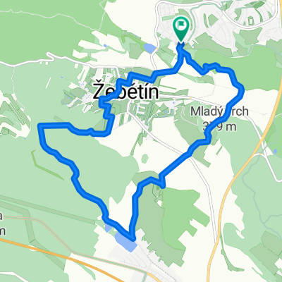
Overview
About this route
- dubna 2022 s Věrou
- -:--
- Duration
- 51.6 km
- Distance
- 579 m
- Ascent
- 554 m
- Descent
- ---
- Avg. speed
- 357 m
- Max. altitude

Route quality
Waytypes & surfaces along the route
Waytypes
Cycleway
15.5 km
(30 %)
Quiet road
12.9 km
(25 %)
Surfaces
Paved
44.9 km
(87 %)
Unpaved
5.2 km
(10 %)
Asphalt
42.3 km
(82 %)
Gravel
5.2 km
(10 %)
Continue with Bikemap
Use, edit, or download this cycling route
You would like to ride 2022_04 Akátová rozhledna or customize it for your own trip? Here is what you can do with this Bikemap route:
Free features
- Save this route as favorite or in collections
- Copy & plan your own version of this route
- Sync your route with Garmin or Wahoo
Premium features
Free trial for 3 days, or one-time payment. More about Bikemap Premium.
- Navigate this route on iOS & Android
- Export a GPX / KML file of this route
- Create your custom printout (try it for free)
- Download this route for offline navigation
Discover more Premium features.
Get Bikemap PremiumFrom our community
Other popular routes starting in Troubsko
 Jirkovo utrpeni
- Distance
- 54.3 km
- Ascent
- 695 m
- Descent
- 727 m
- Location
- Troubsko, South Moravian, Czechia
 26.4.2010 Ztracená cesta
- Distance
- 29.6 km
- Ascent
- 507 m
- Descent
- 505 m
- Location
- Troubsko, South Moravian, Czechia
 3. Etappe - Brno to Tábor - Saturday 28th April
- Distance
- 166.7 km
- Ascent
- 1,302 m
- Descent
- 1,106 m
- Location
- Troubsko, South Moravian, Czechia
 to Motodrom from Bystrec
- Distance
- 13.1 km
- Ascent
- 317 m
- Descent
- 298 m
- Location
- Troubsko, South Moravian, Czechia
 Brno - Budapešť
- Distance
- 470.3 km
- Ascent
- 346 m
- Descent
- 491 m
- Location
- Troubsko, South Moravian, Czechia
 Kolem žebětína
- Distance
- 11.7 km
- Ascent
- 257 m
- Descent
- 259 m
- Location
- Troubsko, South Moravian, Czechia
 jen tak
- Distance
- 55.5 km
- Ascent
- 921 m
- Descent
- 931 m
- Location
- Troubsko, South Moravian, Czechia
 Bílý potok
- Distance
- 54.6 km
- Ascent
- 948 m
- Descent
- 1,004 m
- Location
- Troubsko, South Moravian, Czechia
Open it in the app