
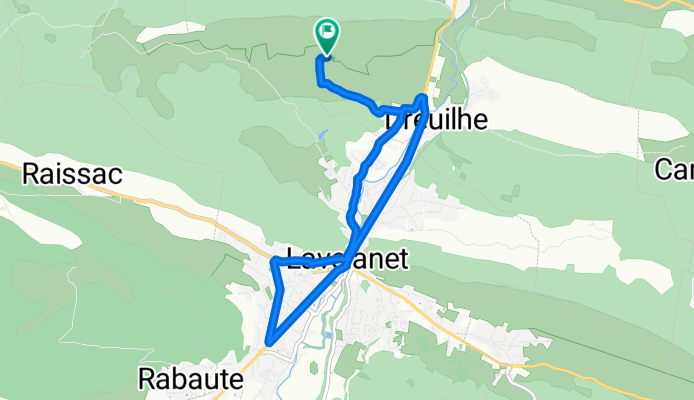
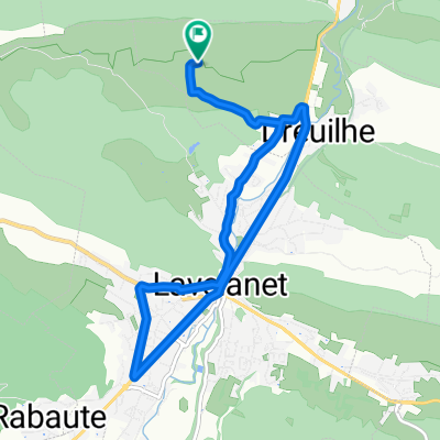
Balade 25/06/11
A cycling route starting in Lavelanet, Occitanie, France.
Overview
About this route
- -:--
- Duration
- 10 km
- Distance
- 187 m
- Ascent
- 187 m
- Descent
- ---
- Avg. speed
- ---
- Max. altitude
Route quality
Waytypes & surfaces along the route
Waytypes
Quiet road
6.8 km
(68 %)
Cycleway
0.8 km
(8 %)
Surfaces
Paved
0.9 km
(9 %)
Asphalt
0.9 km
(9 %)
Undefined
9.1 km
(91 %)
Route highlights
Points of interest along the route
Point of interest after 10 km
Continue with Bikemap
Use, edit, or download this cycling route
You would like to ride Balade 25/06/11 or customize it for your own trip? Here is what you can do with this Bikemap route:
Free features
- Save this route as favorite or in collections
- Copy & plan your own version of this route
- Sync your route with Garmin or Wahoo
Premium features
Free trial for 3 days, or one-time payment. More about Bikemap Premium.
- Navigate this route on iOS & Android
- Export a GPX / KML file of this route
- Create your custom printout (try it for free)
- Download this route for offline navigation
Discover more Premium features.
Get Bikemap PremiumFrom our community
Other popular routes starting in Lavelanet
 Pyrenäen 2000 Etappe 15
- Distance
- 87 km
- Ascent
- 1,042 m
- Descent
- 1,416 m
- Location
- Lavelanet, Occitanie, France
 ddsdq
ddsdq- Distance
- 20 km
- Ascent
- 186 m
- Descent
- 255 m
- Location
- Lavelanet, Occitanie, France
 Balade 25/06/11
- Distance
- 10 km
- Ascent
- 187 m
- Descent
- 187 m
- Location
- Lavelanet, Occitanie, France
 Lavelanet-Boucle 68Km
- Distance
- 67.8 km
- Ascent
- 546 m
- Descent
- 546 m
- Location
- Lavelanet, Occitanie, France
 CC Etapa 03 MONTSÉGUR a PUIVERT
- Distance
- 47 km
- Ascent
- 573 m
- Descent
- 889 m
- Location
- Lavelanet, Occitanie, France
 Etape 5 : Levelanet - Ax-Les-Thermes via Montsegur
- Distance
- 74.7 km
- Ascent
- 2,473 m
- Descent
- 2,273 m
- Location
- Lavelanet, Occitanie, France
 Montsegur a Brindisi
- Distance
- 3,190.5 km
- Ascent
- 7,935 m
- Descent
- 8,840 m
- Location
- Lavelanet, Occitanie, France
 Lavelanet - Puigserdà
- Distance
- 109.4 km
- Ascent
- 1,795 m
- Descent
- 1,115 m
- Location
- Lavelanet, Occitanie, France
Open it in the app