

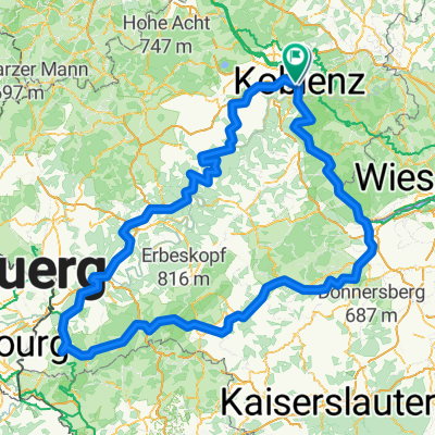
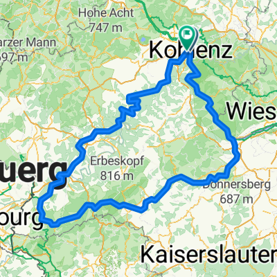
CYCLING THE RHINE: Route 12A
A cycling route starting in Koblenz, Rhineland-Palatinate, Germany.
Overview
About this route
From Koblenz railway station to Bacharach railway station, following the Rhine river.
Please Note that the profile incorrectly shows some high points that do not exist, particularly at about the 5km and 40km marks.- -:--
- Duration
- 49.7 km
- Distance
- 179 m
- Ascent
- 152 m
- Descent
- ---
- Avg. speed
- ---
- Max. altitude
Route quality
Waytypes & surfaces along the route
Waytypes
Path
22.4 km
(45 %)
Access road
7 km
(14 %)
Surfaces
Paved
34.3 km
(69 %)
Unpaved
1 km
(2 %)
Asphalt
29.3 km
(59 %)
Paved (undefined)
3 km
(6 %)
Route highlights
Points of interest along the route
Accommodation after 0.8 km
I have camped here and found the facilities to be excellent. The sounds of the passing river traffic is magical.
Accommodation after 0.8 km
YOUTH HOSTEL: DJH Ehrenbreitstein This Youth Hostel is in the Ehrenbreitstein fortress, the second largest fortress in Europe.
Point of interest after 6.4 km
Ferry
Accommodation after 8.7 km
Hotel Restaurant Roter Ochse, Hochstraße 27, 56321 RHENS. I have stayed here and highly recommend this family run establishment, both the accommodation and the cuisine. It is very cyclist-friendly too.
Point of interest after 16.2 km
Halfway point of the navigable length of the Rhine
Point of interest after 21.6 km
Ferry: Boppard - Filsen
Point of interest after 36.7 km
Ferry: St Goarhausen - St Goar
Accommodation after 46.7 km
YOUTH HOSTEL: DJH Kaub
Point of interest after 49.5 km
At this point the route leaves the Rhine Route, to terminate at Bacharach Railway Station.
Accommodation after 49.6 km
YOUTH HOSTEL: DJH Burg Stahleck. In a Castle.
Continue with Bikemap
Use, edit, or download this cycling route
You would like to ride CYCLING THE RHINE: Route 12A or customize it for your own trip? Here is what you can do with this Bikemap route:
Free features
- Save this route as favorite or in collections
- Copy & plan your own version of this route
- Sync your route with Garmin or Wahoo
Premium features
Free trial for 3 days, or one-time payment. More about Bikemap Premium.
- Navigate this route on iOS & Android
- Export a GPX / KML file of this route
- Create your custom printout (try it for free)
- Download this route for offline navigation
Discover more Premium features.
Get Bikemap PremiumFrom our community
Other popular routes starting in Koblenz
 Mosel-Radweg
- Distance
- 266.6 km
- Ascent
- 2,624 m
- Descent
- 2,533 m
- Location
- Koblenz, Rhineland-Palatinate, Germany
 moseltour trier - koblenz
- Distance
- 205.6 km
- Ascent
- 554 m
- Descent
- 483 m
- Location
- Koblenz, Rhineland-Palatinate, Germany
 Mosel Thionville Mosel
- Distance
- 267 km
- Ascent
- 1,060 m
- Descent
- 989 m
- Location
- Koblenz, Rhineland-Palatinate, Germany
- Von Mayen (Osteifel) nach Koblenz (Rhein)
- Distance
- 54.9 km
- Ascent
- 421 m
- Descent
- 223 m
- Location
- Koblenz, Rhineland-Palatinate, Germany
 Weißenthurm - Altstadt Sud
- Distance
- 94.4 km
- Ascent
- 460 m
- Descent
- 482 m
- Location
- Koblenz, Rhineland-Palatinate, Germany
 Roman Gebbi
- Distance
- 417.8 km
- Ascent
- 5,302 m
- Descent
- 5,303 m
- Location
- Koblenz, Rhineland-Palatinate, Germany
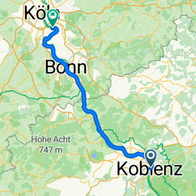
 #16 Koblenz to Bonn
- Distance
- 70.7 km
- Ascent
- 59 m
- Descent
- 66 m
- Location
- Koblenz, Rhineland-Palatinate, Germany
 Roman Gebbi
- Distance
- 403 km
- Ascent
- 5,182 m
- Descent
- 5,184 m
- Location
- Koblenz, Rhineland-Palatinate, Germany

Open it in the app