

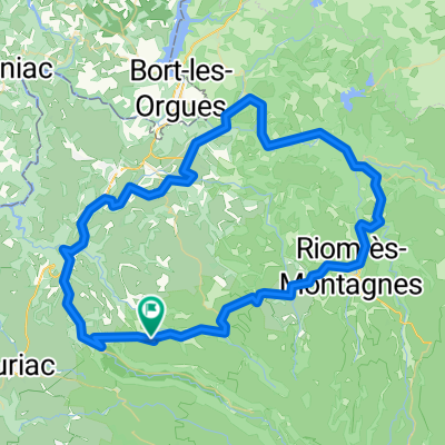
Tour Cantal
A cycling route starting in Ydes, Auvergne-Rhône-Alpes, France.
Overview
About this route
- -:--
- Duration
- 242.2 km
- Distance
- 5,891 m
- Ascent
- 5,848 m
- Descent
- ---
- Avg. speed
- 1,581 m
- Max. altitude

Route quality
Waytypes & surfaces along the route
Waytypes
Busy road
111.6 km
(46 %)
Road
76.4 km
(32 %)
Surfaces
Paved
98.9 km
(41 %)
Unpaved
2.2 km
(<1 %)
Asphalt
98.6 km
(41 %)
Gravel
2 km
(<1 %)
Continue with Bikemap
Use, edit, or download this cycling route
You would like to ride Tour Cantal or customize it for your own trip? Here is what you can do with this Bikemap route:
Free features
- Save this route as favorite or in collections
- Copy & plan your own version of this route
- Split it into stages to create a multi-day tour
- Sync your route with Garmin or Wahoo
Premium features
Free trial for 3 days, or one-time payment. More about Bikemap Premium.
- Navigate this route on iOS & Android
- Export a GPX / KML file of this route
- Create your custom printout (try it for free)
- Download this route for offline navigation
Discover more Premium features.
Get Bikemap PremiumFrom our community
Other popular routes starting in Ydes
 Les deux versans du col d'Aulac
- Distance
- 28.1 km
- Ascent
- 784 m
- Descent
- 353 m
- Location
- Ydes, Auvergne-Rhône-Alpes, France
 Moussageoise 85 km
- Distance
- 84.9 km
- Ascent
- 949 m
- Descent
- 949 m
- Location
- Ydes, Auvergne-Rhône-Alpes, France
 De ¿o7?? à ¿o7??
- Distance
- 5.1 km
- Ascent
- 80 m
- Descent
- 20 m
- Location
- Ydes, Auvergne-Rhône-Alpes, France
 M Ydes Forges 2019
- Distance
- 88.6 km
- Ascent
- 1,049 m
- Descent
- 1,262 m
- Location
- Ydes, Auvergne-Rhône-Alpes, France
 KONALORISPROJECT TESTING CHRONO
- Distance
- 31.9 km
- Ascent
- 304 m
- Descent
- 305 m
- Location
- Ydes, Auvergne-Rhône-Alpes, France
 Tour Cantal
- Distance
- 242.2 km
- Ascent
- 5,891 m
- Descent
- 5,848 m
- Location
- Ydes, Auvergne-Rhône-Alpes, France
 Preparation a une sortie en montagne
- Distance
- 50 km
- Ascent
- 749 m
- Descent
- 749 m
- Location
- Ydes, Auvergne-Rhône-Alpes, France
 2023 voie verte ydes--bassignac
- Distance
- 9.6 km
- Ascent
- 518 m
- Descent
- 518 m
- Location
- Ydes, Auvergne-Rhône-Alpes, France
Open it in the app