

BK Semič Vinica 2022
A cycling route starting in Semič, Občina Semič, Slovenia.
Overview
About this route
Semič, Črnomelj, Tribuče, Bojanci, Vinica, Preloka, Dolenjci, Krasinec, Stranska vas, Semič 66 km
Lahkoj skarjšaš Nova Gorica - Griblje potem 42 km
- -:--
- Duration
- 66.3 km
- Distance
- 748 m
- Ascent
- 753 m
- Descent
- ---
- Avg. speed
- 298 m
- Max. altitude

Route quality
Waytypes & surfaces along the route
Waytypes
Road
40.4 km
(61 %)
Quiet road
23.2 km
(35 %)
Surfaces
Paved
46.4 km
(70 %)
Unpaved
4.6 km
(7 %)
Asphalt
46.4 km
(70 %)
Gravel
4.6 km
(7 %)
Undefined
15.3 km
(23 %)
Continue with Bikemap
Use, edit, or download this cycling route
You would like to ride BK Semič Vinica 2022 or customize it for your own trip? Here is what you can do with this Bikemap route:
Free features
- Save this route as favorite or in collections
- Copy & plan your own version of this route
- Sync your route with Garmin or Wahoo
Premium features
Free trial for 3 days, or one-time payment. More about Bikemap Premium.
- Navigate this route on iOS & Android
- Export a GPX / KML file of this route
- Create your custom printout (try it for free)
- Download this route for offline navigation
Discover more Premium features.
Get Bikemap PremiumFrom our community
Other popular routes starting in Semič
 BK Semič Metlika, krog 43 km
- Distance
- 43.7 km
- Ascent
- 558 m
- Descent
- 589 m
- Location
- Semič, Občina Semič, Slovenia
 G-S-Č-G
- Distance
- 23.2 km
- Ascent
- 160 m
- Descent
- 160 m
- Location
- Semič, Občina Semič, Slovenia
 Untitled route
- Distance
- 50.6 km
- Ascent
- 624 m
- Descent
- 625 m
- Location
- Semič, Občina Semič, Slovenia
 BK Semič Vinica 2022
- Distance
- 66.3 km
- Ascent
- 748 m
- Descent
- 753 m
- Location
- Semič, Občina Semič, Slovenia
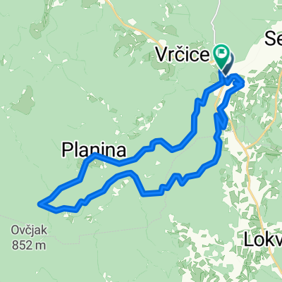 Gorenci - Planina #2
- Distance
- 21.3 km
- Ascent
- 641 m
- Descent
- 638 m
- Location
- Semič, Občina Semič, Slovenia
 From Semič to Dolenjske Toplice
- Distance
- 18.2 km
- Ascent
- 460 m
- Descent
- 585 m
- Location
- Semič, Občina Semič, Slovenia
 G-VK-Č-G
- Distance
- 14.8 km
- Ascent
- 104 m
- Descent
- 106 m
- Location
- Semič, Občina Semič, Slovenia
 G-M-KV-S-Č-G
- Distance
- 36.6 km
- Ascent
- 258 m
- Descent
- 258 m
- Location
- Semič, Občina Semič, Slovenia
Open it in the app