
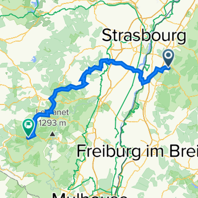
Schulstraße 15/1, Offenburg nach Schulstraße 1, Offenburg
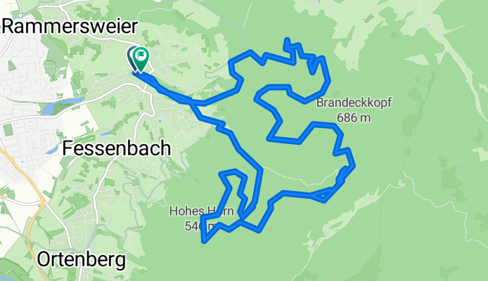
A cycling route starting in Ortenberg, Baden-Württemberg, Germany.
Overview
About this route
- 4 h 1 min
- Duration
- 20.8 km
- Distance
- 1,312 m
- Ascent
- 1,309 m
- Descent
- 5.2 km/h
- Avg. speed
- 622 m
- Avg. speed

Route quality
Waytypes & surfaces along the route
Waytypes
Track
15.4 km
(74 %)
Path
2.7 km
(13 %)
Surfaces
Paved
4 km
(19 %)
Unpaved
14.5 km
(70 %)
Gravel
11.1 km
(53 %)
Asphalt
3.2 km
(16 %)
Continue with Bikemap
Use, edit, or download this cycling route
You would like to ride Schulstraße 15/1, Offenburg nach Schulstraße 1, Offenburg or customize it for your own trip? Here is what you can do with this Bikemap route:
Free features
- Save this route as favorite or in collections
- Copy & plan your own version of this route
- Sync your route with Garmin or Wahoo
Premium features
Free trial for 3 days, or one-time payment. More about Bikemap Premium.
- Navigate this route on iOS & Android
- Export a GPX / KML file of this route
- Create your custom printout (try it for free)
- Download this route for offline navigation
Discover more Premium features.
Get Bikemap PremiumFrom our community
Other popular routes starting in Ortenberg
 Rund ums Geiger Köpfle
- Distance
- 41.3 km
- Ascent
- 235 m
- Descent
- 232 m
- Location
- Ortenberg, Baden-Württemberg, Germany
 Route 1 Elsaßtour (Roller)
- Distance
- 156.5 km
- Ascent
- 1,776 m
- Descent
- 1,288 m
- Location
- Ortenberg, Baden-Württemberg, Germany
 Ofg-Hausach-Gutach-Elzach-Kenzingen-Wyhl-Rust-Schwanau-Ofg
- Distance
- 176.3 km
- Ascent
- 969 m
- Descent
- 945 m
- Location
- Ortenberg, Baden-Württemberg, Germany
 Schönberg ( einfach )
- Distance
- 49.2 km
- Ascent
- 309 m
- Descent
- 308 m
- Location
- Ortenberg, Baden-Württemberg, Germany
 MTB-Strohbach
- Distance
- 30.5 km
- Ascent
- 495 m
- Descent
- 493 m
- Location
- Ortenberg, Baden-Württemberg, Germany
 Elsass 2021
- Distance
- 297.1 km
- Ascent
- 434 m
- Descent
- 517 m
- Location
- Ortenberg, Baden-Württemberg, Germany
 Zell-Weierbach - Wetterfähnle - Wolfsgrube - Zeller-Brunnen - Brandeck - Fritscheneck - Hohes-Horn - Albersbach - Riedle- Zell-Weierbach
- Distance
- 15.7 km
- Ascent
- 698 m
- Descent
- 698 m
- Location
- Ortenberg, Baden-Württemberg, Germany
 Sattlerweg 2, Offenburg nach Blumenstraße 4A, Hohberg
- Distance
- 66.8 km
- Ascent
- 1,157 m
- Descent
- 1,150 m
- Location
- Ortenberg, Baden-Württemberg, Germany
Open it in the app