

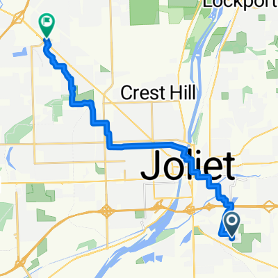
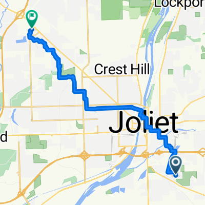
Preston Heights 1
A cycling route starting in Preston Heights, Illinois, United States.
Overview
About this route
- 1 h 11 min
- Duration
- 22.7 km
- Distance
- 116 m
- Ascent
- 81 m
- Descent
- 19.2 km/h
- Avg. speed
- 201 m
- Max. altitude
Route quality
Waytypes & surfaces along the route
Waytypes
Quiet road
12.1 km
(53 %)
Road
7.5 km
(33 %)
Surfaces
Paved
3.2 km
(14 %)
Paved (undefined)
2 km
(9 %)
Asphalt
1.1 km
(5 %)
Undefined
19.6 km
(86 %)
Continue with Bikemap
Use, edit, or download this cycling route
You would like to ride Preston Heights 1 or customize it for your own trip? Here is what you can do with this Bikemap route:
Free features
- Save this route as favorite or in collections
- Copy & plan your own version of this route
- Sync your route with Garmin or Wahoo
Premium features
Free trial for 3 days, or one-time payment. More about Bikemap Premium.
- Navigate this route on iOS & Android
- Export a GPX / KML file of this route
- Create your custom printout (try it for free)
- Download this route for offline navigation
Discover more Premium features.
Get Bikemap PremiumFrom our community
Other popular routes starting in Preston Heights
 Preston Heights 1
- Distance
- 22.7 km
- Ascent
- 116 m
- Descent
- 81 m
- Location
- Preston Heights, Illinois, United States
 Rowell Avenue to Plainfield Road
- Distance
- 17.1 km
- Ascent
- 61 m
- Descent
- 74 m
- Location
- Preston Heights, Illinois, United States
 Mills Road 410, Joliet to Plainfield Road 1424, Joliet
- Distance
- 30.3 km
- Ascent
- 173 m
- Descent
- 156 m
- Location
- Preston Heights, Illinois, United States
 Rowell Avenue to Plainfield Road
- Distance
- 17.7 km
- Ascent
- 61 m
- Descent
- 75 m
- Location
- Preston Heights, Illinois, United States
Open it in the app