
220424 Brittany circuit with 2 campsites v2 West
A cycling route starting in Huelgoat, Brittany Region, France.
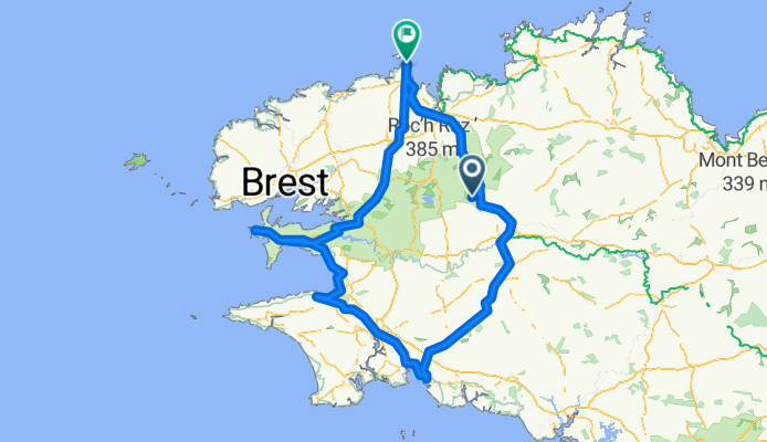
Overview
About this route
option to go West back up coast
- -:--
- Duration
- 406.9 km
- Distance
- 3,981 m
- Ascent
- 4,069 m
- Descent
- ---
- Avg. speed
- 222 m
- Max. altitude

Route quality
Waytypes & surfaces along the route
Waytypes
Path
135.5 km
(33 %)
Quiet road
89.2 km
(22 %)
Surfaces
Paved
144.5 km
(36 %)
Unpaved
133.9 km
(33 %)
Asphalt
137.3 km
(34 %)
Gravel
62.1 km
(15 %)
Route highlights
Points of interest along the route
Point of interest after 197.3 km
Concarneau camp site
Point of interest after 252.3 km
Optional Douarnenez campsite - not researched. 3 others near by.
Point of interest after 308 km
Night 5 campsite chosen at random along North West coast line (not researched)
Point of interest after 308.1 km
Optional campsite at Cabaret-sur-Mer (not researched) - appears to be the only one in town
Point of interest after 370.4 km
Optional camp site for night 5 on return to Roscoff (not researched)
Point of interest after 379.2 km
Optional campsite on North West coast line (not researched)
Continue with Bikemap
Use, edit, or download this cycling route
You would like to ride 220424 Brittany circuit with 2 campsites v2 West or customize it for your own trip? Here is what you can do with this Bikemap route:
Free features
- Save this route as favorite or in collections
- Copy & plan your own version of this route
- Split it into stages to create a multi-day tour
- Sync your route with Garmin or Wahoo
Premium features
Free trial for 3 days, or one-time payment. More about Bikemap Premium.
- Navigate this route on iOS & Android
- Export a GPX / KML file of this route
- Create your custom printout (try it for free)
- Download this route for offline navigation
Discover more Premium features.
Get Bikemap PremiumFrom our community
Other popular routes starting in Huelgoat
 220424 Brittany circuit with 2 campsites v2 West
- Distance
- 406.9 km
- Ascent
- 3,981 m
- Descent
- 4,069 m
- Location
- Huelgoat, Brittany Region, France
 huelgoat - vallée des saints
- Distance
- 46.5 km
- Ascent
- 596 m
- Descent
- 596 m
- Location
- Huelgoat, Brittany Region, France
 220424 Brittany circuit with 2 campsites v3 West
- Distance
- 414.6 km
- Ascent
- 3,974 m
- Descent
- 4,061 m
- Location
- Huelgoat, Brittany Region, France
 ene drinken?
- Distance
- 5.5 km
- Ascent
- 139 m
- Descent
- 136 m
- Location
- Huelgoat, Brittany Region, France
 huelgoat
- Distance
- 24.6 km
- Ascent
- 445 m
- Descent
- 446 m
- Location
- Huelgoat, Brittany Region, France
 Brennilis : circuit VTT de Brennilis
- Distance
- 11.8 km
- Ascent
- 0 m
- Descent
- 0 m
- Location
- Huelgoat, Brittany Region, France
 Berrien nach Castel Meur 3, Plougrescant
- Distance
- 89.3 km
- Ascent
- 241 m
- Descent
- 589 m
- Location
- Huelgoat, Brittany Region, France
 huelgoat left of lake
- Distance
- 15.9 km
- Ascent
- 203 m
- Descent
- 202 m
- Location
- Huelgoat, Brittany Region, France
Open it in the app