

220424 Brittany circuit with 2 campsites v3 West
A cycling route starting in Huelgoat, Brittany Region, France.
Overview
About this route
trying better cycle route for day 4 and 5
- -:--
- Duration
- 414.6 km
- Distance
- 3,974 m
- Ascent
- 4,061 m
- Descent
- ---
- Avg. speed
- 272 m
- Max. altitude

Route quality
Waytypes & surfaces along the route
Waytypes
Path
145.1 km
(35 %)
Quiet road
95.4 km
(23 %)
Surfaces
Paved
161.7 km
(39 %)
Unpaved
149.2 km
(36 %)
Asphalt
157.5 km
(38 %)
Gravel
70.5 km
(17 %)
Route highlights
Points of interest along the route
Point of interest after 196.3 km
Concarneau camp site
Point of interest after 251.1 km
Optional Douarnenez campsite - not researched. 3 others near by.
Point of interest after 306.5 km
Night 5 campsite chosen at random along North West coast line (not researched)
Point of interest after 306.6 km
Optional campsite at Cabaret-sur-Mer (not researched) - appears to be the only one in town
Point of interest after 369.4 km
Optional camp site for night 5 on return to Roscoff (not researched)
Point of interest after 375.9 km
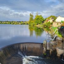
Day 5 campsite option (not research) looks better by the lake
Point of interest after 405.7 km
Optional campsite on North West coast line (not researched)
Point of interest after 414.6 km
Mercure hotel Roscoff booked by Bill
Continue with Bikemap
Use, edit, or download this cycling route
You would like to ride 220424 Brittany circuit with 2 campsites v3 West or customize it for your own trip? Here is what you can do with this Bikemap route:
Free features
- Save this route as favorite or in collections
- Copy & plan your own version of this route
- Split it into stages to create a multi-day tour
- Sync your route with Garmin or Wahoo
Premium features
Free trial for 3 days, or one-time payment. More about Bikemap Premium.
- Navigate this route on iOS & Android
- Export a GPX / KML file of this route
- Create your custom printout (try it for free)
- Download this route for offline navigation
Discover more Premium features.
Get Bikemap PremiumFrom our community
Other popular routes starting in Huelgoat
 étape 3 Bretagne 2025
- Distance
- 82.7 km
- Ascent
- 1,044 m
- Descent
- 1,138 m
- Location
- Huelgoat, Brittany Region, France
 huelgoat
- Distance
- 24.6 km
- Ascent
- 445 m
- Descent
- 446 m
- Location
- Huelgoat, Brittany Region, France
 huelgoat - vallée des saints
- Distance
- 46.5 km
- Ascent
- 596 m
- Descent
- 596 m
- Location
- Huelgoat, Brittany Region, France
 Berrien nach Castel Meur 3, Plougrescant
- Distance
- 89.3 km
- Ascent
- 241 m
- Descent
- 589 m
- Location
- Huelgoat, Brittany Region, France
 Huelgoat- Gouarec
- Distance
- 71.7 km
- Ascent
- 461 m
- Descent
- 544 m
- Location
- Huelgoat, Brittany Region, France
 ene drinken?
- Distance
- 5.5 km
- Ascent
- 139 m
- Descent
- 136 m
- Location
- Huelgoat, Brittany Region, France
 220424 Brittany circuit with 2 campsites v2 West
- Distance
- 406.9 km
- Ascent
- 3,981 m
- Descent
- 4,069 m
- Location
- Huelgoat, Brittany Region, France
 Rue des Cendres nach Rue de l'Église
- Distance
- 55.4 km
- Ascent
- 539 m
- Descent
- 578 m
- Location
- Huelgoat, Brittany Region, France
Open it in the app