

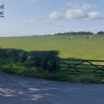
Old Malton / Sheriff / Terrington 260422 - 28.1m
A cycling route starting in Malton, England, United Kingdom.
Overview
About this route
0
- -:--
- Duration
- 45.3 km
- Distance
- 534 m
- Ascent
- 534 m
- Descent
- ---
- Avg. speed
- 119 m
- Max. altitude
Matthew Rohan
created this 4 years ago
Route quality
Waytypes & surfaces along the route
Waytypes
Road
27.6 km
61 %
Quiet road
10.4 km
23 %
Surfaces
Paved
31.7 km
(70 %)
Unpaved
1.8 km
(4 %)
Asphalt
31.7 km
70 %
Gravel
0.9 km
2 %
Continue with Bikemap
Use, edit, or download this cycling route
You would like to ride Old Malton / Sheriff / Terrington 260422 - 28.1m or customize it for your own trip? Here is what you can do with this Bikemap route:
Free features
- Save this route as favorite or in collections
- Copy & plan your own version of this route
- Sync your route with Garmin or Wahoo
Premium features
Free trial for 3 days, or one-time payment. More about Bikemap Premium.
- Navigate this route on iOS & Android
- Export a GPX / KML file of this route
- Create your custom printout (try it for free)
- Download this route for offline navigation
Discover more Premium features.
Get Bikemap PremiumFrom our community
Other popular routes starting in Malton


Open it in the app