

Overview
About this route
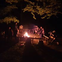
KST Dubnica - každoročný turistický pochod koncom apríla.
- -:--
- Duration
- 30.8 km
- Distance
- 1,449 m
- Ascent
- 1,447 m
- Descent
- ---
- Avg. speed
- 899 m
- Max. altitude

Part of
Dubnická 30ka
4 stages
Route quality
Waytypes & surfaces along the route
Waytypes
Track
22.8 km
(74 %)
Path
5.2 km
(17 %)
Surfaces
Paved
1.5 km
(5 %)
Unpaved
14.5 km
(47 %)
Ground
9.9 km
(32 %)
Unpaved (undefined)
3.7 km
(12 %)
Continue with Bikemap
Use, edit, or download this cycling route
You would like to ride Dubnická 35ka or customize it for your own trip? Here is what you can do with this Bikemap route:
Free features
- Save this route as favorite or in collections
- Copy & plan your own version of this route
- Sync your route with Garmin or Wahoo
Premium features
Free trial for 3 days, or one-time payment. More about Bikemap Premium.
- Navigate this route on iOS & Android
- Export a GPX / KML file of this route
- Create your custom printout (try it for free)
- Download this route for offline navigation
Discover more Premium features.
Get Bikemap PremiumFrom our community
Other popular routes starting in Dubnica nad Váhom
 Centrum I. 130 do Centrum I. 130
- Distance
- 47.7 km
- Ascent
- 1,261 m
- Descent
- 1,275 m
- Location
- Dubnica nad Váhom, Nitra Region, Slovakia
 Centrum I. 130 do Centrum I. 130
- Distance
- 69.8 km
- Ascent
- 813 m
- Descent
- 841 m
- Location
- Dubnica nad Váhom, Nitra Region, Slovakia
 vkt17 brezová kaplnka
- Distance
- 27 km
- Ascent
- 655 m
- Descent
- 447 m
- Location
- Dubnica nad Váhom, Nitra Region, Slovakia
 Centrum I. 130 do Říky, Brumov-Bylnice
- Distance
- 22.2 km
- Ascent
- 239 m
- Descent
- 171 m
- Location
- Dubnica nad Váhom, Nitra Region, Slovakia
 cez Sidoniu na Vrsatec
- Distance
- 53.7 km
- Ascent
- 1,144 m
- Descent
- 1,203 m
- Location
- Dubnica nad Váhom, Nitra Region, Slovakia
 Poza Váh
- Distance
- 24.3 km
- Ascent
- 58 m
- Descent
- 58 m
- Location
- Dubnica nad Váhom, Nitra Region, Slovakia
 Dubnica - Zliechov - Dubnica
- Distance
- 70.3 km
- Ascent
- 828 m
- Descent
- 828 m
- Location
- Dubnica nad Váhom, Nitra Region, Slovakia
 Skalka
- Distance
- 17.5 km
- Ascent
- 62 m
- Descent
- 83 m
- Location
- Dubnica nad Váhom, Nitra Region, Slovakia
Open it in the app