

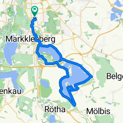
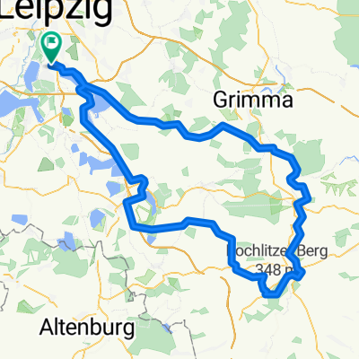
Radrunde Windorf-Lützen-Pegau-Windorf
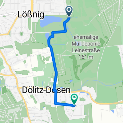
A cycling route starting in Markkleeberg, Saxony, Germany.
Overview
About this route
Rundfahrt durch das südwestliche Neuseenland entlang alter Bahnstrecken, Floßgräben und der Elster.
- -:--
- Duration
- 69.1 km
- Distance
- 114 m
- Ascent
- 116 m
- Descent
- ---
- Avg. speed
- 170 m
- Max. altitude

Route quality
Waytypes & surfaces along the route
Waytypes
Track
21.4 km
(31 %)
Quiet road
14.5 km
(21 %)
Surfaces
Paved
51.1 km
(74 %)
Unpaved
12.4 km
(18 %)
Asphalt
49.8 km
(72 %)
Ground
6.9 km
(10 %)
Continue with Bikemap
Use, edit, or download this cycling route
You would like to ride Radrunde Windorf-Lützen-Pegau-Windorf or customize it for your own trip? Here is what you can do with this Bikemap route:
Free features
- Save this route as favorite or in collections
- Copy & plan your own version of this route
- Sync your route with Garmin or Wahoo
Premium features
Free trial for 3 days, or one-time payment. More about Bikemap Premium.
- Navigate this route on iOS & Android
- Export a GPX / KML file of this route
- Create your custom printout (try it for free)
- Download this route for offline navigation
Discover more Premium features.
Get Bikemap PremiumFrom our community
Other popular routes starting in Markkleeberg
 Pleißeradweg von Markkleeberg nach Regis-Breitingen
- Distance
- 28.5 km
- Ascent
- 95 m
- Descent
- 50 m
- Location
- Markkleeberg, Saxony, Germany
 Am Wolfswinkel nach Am Wolfswinkel
- Distance
- 21 km
- Ascent
- 107 m
- Descent
- 148 m
- Location
- Markkleeberg, Saxony, Germany
 Siedlung Goldene Höhe, Markkleeberg nach Am Wolfswinkel, Markkleeberg
- Distance
- 14 km
- Ascent
- 106 m
- Descent
- 112 m
- Location
- Markkleeberg, Saxony, Germany
 Gustav-Meisel-Straße nach Ebersbrunn
- Distance
- 102.8 km
- Ascent
- 602 m
- Descent
- 341 m
- Location
- Markkleeberg, Saxony, Germany
 Seen-Rundfahrt CLONED FROM ROUTE 324751
- Distance
- 78.3 km
- Ascent
- 145 m
- Descent
- 153 m
- Location
- Markkleeberg, Saxony, Germany
 Route Alt Connewitz
- Distance
- 40.1 km
- Ascent
- 162 m
- Descent
- 162 m
- Location
- Markkleeberg, Saxony, Germany
 Route in Leipzig
- Distance
- 2.6 km
- Ascent
- 14 m
- Descent
- 7 m
- Location
- Markkleeberg, Saxony, Germany
 Rochlitzer Berg
- Distance
- 121 km
- Ascent
- 818 m
- Descent
- 820 m
- Location
- Markkleeberg, Saxony, Germany
Open it in the app