

Obdacherhöhe - St. Georgen a.Obdachegg - Kathal - Obdach
A cycling route starting in Obdach, Styria, Austria.
Overview
About this route
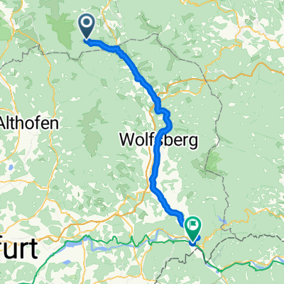
From Obdacherhöhe to St. Georgen in Obdachegg up to Kathal on an asphalted municipal road. From the junction Kienberger Street on a new asphalted bike path or asphalted municipal road to Obdach/Main Square
- -:--
- Duration
- 18.1 km
- Distance
- 397 m
- Ascent
- 480 m
- Descent
- ---
- Avg. speed
- ---
- Max. altitude
Route quality
Waytypes & surfaces along the route
Waytypes
Quiet road
5.1 km
(28 %)
Road
3.6 km
(20 %)
Surfaces
Paved
3.8 km
(21 %)
Unpaved
0.5 km
(3 %)
Asphalt
3.8 km
(21 %)
Loose gravel
0.5 km
(3 %)
Undefined
13.8 km
(76 %)
Continue with Bikemap
Use, edit, or download this cycling route
You would like to ride Obdacherhöhe - St. Georgen a.Obdachegg - Kathal - Obdach or customize it for your own trip? Here is what you can do with this Bikemap route:
Free features
- Save this route as favorite or in collections
- Copy & plan your own version of this route
- Sync your route with Garmin or Wahoo
Premium features
Free trial for 3 days, or one-time payment. More about Bikemap Premium.
- Navigate this route on iOS & Android
- Export a GPX / KML file of this route
- Create your custom printout (try it for free)
- Download this route for offline navigation
Discover more Premium features.
Get Bikemap PremiumFrom our community
Other popular routes starting in Obdach
 Leoben-Obdach-Preitenegg-Pack-Köflach-Gaberl-Leoben
- Distance
- 196 km
- Ascent
- 2,341 m
- Descent
- 2,340 m
- Location
- Obdach, Styria, Austria
 obdach ñach St Paul
- Distance
- 24.2 km
- Ascent
- 11 m
- Descent
- 427 m
- Location
- Obdach, Styria, Austria
 Rudolf-Falb-Gasse 23, Obdach nach Klagenfurterstraße 356, Bad Sankt Leonhard im Lavanttal
- Distance
- 14.2 km
- Ascent
- 114 m
- Descent
- 341 m
- Location
- Obdach, Styria, Austria
 Obdach - Scheifling
- Distance
- 50.4 km
- Ascent
- 278 m
- Descent
- 386 m
- Location
- Obdach, Styria, Austria
 Obdach - Feldalm - St.Anna - Obdach
- Distance
- 33.2 km
- Ascent
- 1,177 m
- Descent
- 1,177 m
- Location
- Obdach, Styria, Austria
 Lavantradweg
- Distance
- 66.2 km
- Ascent
- 24 m
- Descent
- 835 m
- Location
- Obdach, Styria, Austria
 Obdacherhöhe - St. Georgen a.Obdachegg - Kathal - Obdach
- Distance
- 18.1 km
- Ascent
- 397 m
- Descent
- 480 m
- Location
- Obdach, Styria, Austria
 Von Obdach zum Klopeiner See
- Distance
- 81.3 km
- Ascent
- 586 m
- Descent
- 922 m
- Location
- Obdach, Styria, Austria
Open it in the app