

Road to North Cape
A cycling route starting in Portes-lès-Valence, Auvergne-Rhône-Alpes, France.
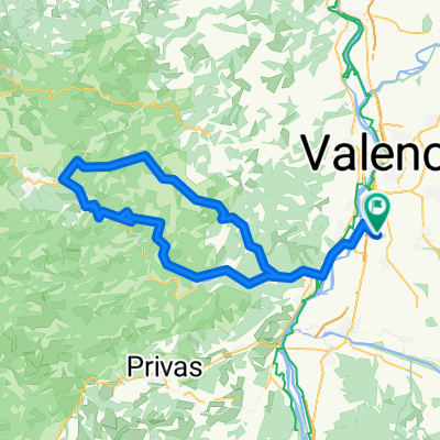
Overview
About this route
Portes > Stuttgart : 823kms
Stuttgart Hambourg en train : 1508-823 = 775kms à enlever
Avant ferry à Frederikshavn : 2320-775 = 1545 kms
Ferry : 100kms
Ferry Bodo > Lofoten 110kms
MAJ apres pres fracture :
Portes - Neuchatel : 430 kms
Neuchatel - Hambourg : 1080 kms en train
Ferry pour Goteborg à 2320km soit 2320-1080 = 1240. En 2 semaines en Suède ?
- -:--
- Duration
- 6,201.1 km
- Distance
- 46,436 m
- Ascent
- 46,314 m
- Descent
- ---
- Avg. speed
- 1,384 m
- Max. altitude
Continue with Bikemap
Use, edit, or download this cycling route
You would like to ride Road to North Cape or customize it for your own trip? Here is what you can do with this Bikemap route:
Free features
- Save this route as favorite or in collections
- Copy & plan your own version of this route
- Split it into stages to create a multi-day tour
- Sync your route with Garmin or Wahoo
Premium features
Free trial for 3 days, or one-time payment. More about Bikemap Premium.
- Navigate this route on iOS & Android
- Export a GPX / KML file of this route
- Create your custom printout (try it for free)
- Download this route for offline navigation
Discover more Premium features.
Get Bikemap PremiumFrom our community
Other popular routes starting in Portes-lès-Valence
 -3. Tour: Valence - Pierrelatte
- Distance
- 71.8 km
- Ascent
- 147 m
- Descent
- 197 m
- Location
- Portes-lès-Valence, Auvergne-Rhône-Alpes, France
 Europe
- Distance
- 11,080.9 km
- Ascent
- 2,878 m
- Descent
- 2,878 m
- Location
- Portes-lès-Valence, Auvergne-Rhône-Alpes, France
 Valence + Chateau de Crussol
- Distance
- 21.8 km
- Ascent
- 185 m
- Descent
- 188 m
- Location
- Portes-lès-Valence, Auvergne-Rhône-Alpes, France
 2021 ?
- Distance
- 10,999.4 km
- Ascent
- 3,414 m
- Descent
- 3,414 m
- Location
- Portes-lès-Valence, Auvergne-Rhône-Alpes, France
 Tour de France Etappe 19 Valence - Orange
- Distance
- 179.8 km
- Ascent
- 552 m
- Descent
- 631 m
- Location
- Portes-lès-Valence, Auvergne-Rhône-Alpes, France
 8 Rue Pablo Picasso, Portes-lès-Valence à 8 Rue Pablo Picasso, Portes-lès-Valence
- Distance
- 25 km
- Ascent
- 246 m
- Descent
- 249 m
- Location
- Portes-lès-Valence, Auvergne-Rhône-Alpes, France
 Test 1
- Distance
- 110.5 km
- Ascent
- 1,429 m
- Descent
- 1,426 m
- Location
- Portes-lès-Valence, Auvergne-Rhône-Alpes, France
 Road to North Cape
- Distance
- 6,201.1 km
- Ascent
- 46,436 m
- Descent
- 46,314 m
- Location
- Portes-lès-Valence, Auvergne-Rhône-Alpes, France
Open it in the app