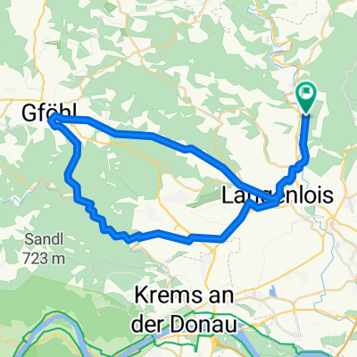
zöbing - Gösing
A cycling route starting in Langenlois, Lower Austria, Austria.
Overview
About this route
- -:--
- Duration
- 32.8 km
- Distance
- 392 m
- Ascent
- 378 m
- Descent
- ---
- Avg. speed
- 357 m
- Avg. speed
Route quality
Waytypes & surfaces along the route
Waytypes
Quiet road
11.5 km
(35 %)
Track
10.4 km
(32 %)
Surfaces
Paved
19.6 km
(60 %)
Unpaved
3.4 km
(10 %)
Asphalt
15.4 km
(47 %)
Paved (undefined)
4.2 km
(13 %)
Route highlights
Points of interest along the route
Point of interest after 16 km
5 eckiger stein
Continue with Bikemap
Use, edit, or download this cycling route
You would like to ride zöbing - Gösing or customize it for your own trip? Here is what you can do with this Bikemap route:
Free features
- Save this route as favorite or in collections
- Copy & plan your own version of this route
- Sync your route with Garmin or Wahoo
Premium features
Free trial for 3 days, or one-time payment. More about Bikemap Premium.
- Navigate this route on iOS & Android
- Export a GPX / KML file of this route
- Create your custom printout (try it for free)
- Download this route for offline navigation
Discover more Premium features.
Get Bikemap PremiumFrom our community
Other popular routes starting in Langenlois
- Tour de Vin 2015
- Distance
- 60.4 km
- Ascent
- 420 m
- Descent
- 421 m
- Location
- Langenlois, Lower Austria, Austria
- 1. Radtour mit Raphi
- Distance
- 2.8 km
- Ascent
- 24 m
- Descent
- 46 m
- Location
- Langenlois, Lower Austria, Austria
- Langenlois MTB Runde
- Distance
- 48.1 km
- Ascent
- 552 m
- Descent
- 552 m
- Location
- Langenlois, Lower Austria, Austria
- Kamptal- und Manhartsberg Radweg
- Distance
- 62.9 km
- Ascent
- 730 m
- Descent
- 728 m
- Location
- Langenlois, Lower Austria, Austria
- Route in Langenlois
- Distance
- 38.8 km
- Ascent
- 589 m
- Descent
- 595 m
- Location
- Langenlois, Lower Austria, Austria
- Gföhler_Runde
- Distance
- 71.2 km
- Ascent
- 457 m
- Descent
- 457 m
- Location
- Langenlois, Lower Austria, Austria
- Schönberg - Rosenburg - Krumau - Schönberg
- Distance
- 77.7 km
- Ascent
- 1,152 m
- Descent
- 1,155 m
- Location
- Langenlois, Lower Austria, Austria
- Straß - Jauerling _1
- Distance
- 123.7 km
- Ascent
- 1,273 m
- Descent
- 1,273 m
- Location
- Langenlois, Lower Austria, Austria
Open it in the app