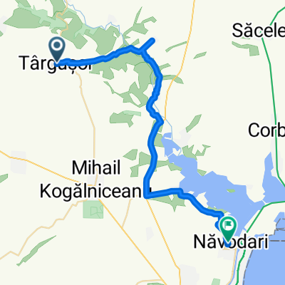
Cheile Dobrogei - varianta 2022
A cycling route starting in Târguşor, Constanța, Romania.
Overview
About this route
- -:--
- Duration
- 32.1 km
- Distance
- 279 m
- Ascent
- 278 m
- Descent
- ---
- Avg. speed
- 134 m
- Avg. speed
Route quality
Waytypes & surfaces along the route
Waytypes
Quiet road
11 km
(34 %)
Track
9.2 km
(29 %)
Surfaces
Paved
4.8 km
(15 %)
Unpaved
12.2 km
(38 %)
Unpaved (undefined)
9 km
(28 %)
Asphalt
4.8 km
(15 %)
Continue with Bikemap
Use, edit, or download this cycling route
You would like to ride Cheile Dobrogei - varianta 2022 or customize it for your own trip? Here is what you can do with this Bikemap route:
Free features
- Save this route as favorite or in collections
- Copy & plan your own version of this route
- Sync your route with Garmin or Wahoo
Premium features
Free trial for 3 days, or one-time payment. More about Bikemap Premium.
- Navigate this route on iOS & Android
- Export a GPX / KML file of this route
- Create your custom printout (try it for free)
- Download this route for offline navigation
Discover more Premium features.
Get Bikemap PremiumFrom our community
Other popular routes starting in Târguşor
- Cheile Dobgrogei
- Distance
- 31.1 km
- Ascent
- 252 m
- Descent
- 254 m
- Location
- Târguşor, Constanța, Romania
- Around Casian
- Distance
- 17.4 km
- Ascent
- 208 m
- Descent
- 209 m
- Location
- Târguşor, Constanța, Romania
- Vadu-Corbul
- Distance
- 129.9 km
- Ascent
- 476 m
- Descent
- 527 m
- Location
- Târguşor, Constanța, Romania
- Cheile Dobrogei
- Distance
- 18.8 km
- Ascent
- 245 m
- Descent
- 245 m
- Location
- Târguşor, Constanța, Romania
- Dobrogea - Casian/ Cheile Dobrogei v2
- Distance
- 31.7 km
- Ascent
- 288 m
- Descent
- 288 m
- Location
- Târguşor, Constanța, Romania
- Tărguşor to DJ222
- Distance
- 8 km
- Ascent
- 141 m
- Descent
- 191 m
- Location
- Târguşor, Constanța, Romania
- Marele Sprint de la Cheile Dobrogei
- Distance
- 28.1 km
- Ascent
- 220 m
- Descent
- 184 m
- Location
- Târguşor, Constanța, Romania
- Cheile Dobrogei in stil Paris-Roubaix
- Distance
- 40.1 km
- Ascent
- 353 m
- Descent
- 354 m
- Location
- Târguşor, Constanța, Romania
Open it in the app