

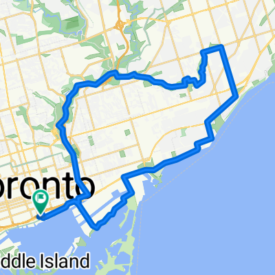
Spencer Avenue 51, Toronto to Spencer Avenue 31, Toronto
A cycling route starting in Toronto, Ontario, Canada.
Overview
About this route
- 17 h 9 min
- Duration
- 24.8 km
- Distance
- 44 m
- Ascent
- 73 m
- Descent
- 1.4 km/h
- Avg. speed
- 105 m
- Max. altitude

Continue with Bikemap
Use, edit, or download this cycling route
You would like to ride Spencer Avenue 51, Toronto to Spencer Avenue 31, Toronto or customize it for your own trip? Here is what you can do with this Bikemap route:
Free features
- Save this route as favorite or in collections
- Copy & plan your own version of this route
- Sync your route with Garmin or Wahoo
Premium features
Free trial for 3 days, or one-time payment. More about Bikemap Premium.
- Navigate this route on iOS & Android
- Export a GPX / KML file of this route
- Create your custom printout (try it for free)
- Download this route for offline navigation
Discover more Premium features.
Get Bikemap PremiumFrom our community
Other popular routes starting in Toronto
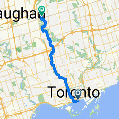
 Lengthy bike tour through Toronto
- Distance
- 36.1 km
- Ascent
- 124 m
- Descent
- 123 m
- Location
- Toronto, Ontario, Canada
 Lighthouse Loop, Toronto
- Distance
- 6.5 km
- Ascent
- 34 m
- Descent
- 4 m
- Location
- Toronto, Ontario, Canada
 От Queens Quay East 25R до McClintock Crescent
- Distance
- 25.3 km
- Ascent
- 211 m
- Descent
- 62 m
- Location
- Toronto, Ontario, Canada
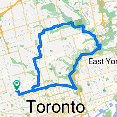
 Long Toronto Loop
- Distance
- 76.9 km
- Ascent
- 374 m
- Descent
- 370 m
- Location
- Toronto, Ontario, Canada
 Pan Am Path (East) Lower Don
- Distance
- 8.8 km
- Ascent
- 48 m
- Descent
- 64 m
- Location
- Toronto, Ontario, Canada
 Ride For Cancer day 1
- Distance
- 102.9 km
- Ascent
- 317 m
- Descent
- 297 m
- Location
- Toronto, Ontario, Canada
 commute to class
- Distance
- 29.6 km
- Ascent
- 252 m
- Descent
- 253 m
- Location
- Toronto, Ontario, Canada
 TCBC to Highland Creek (Morrish & Ellesmere) and beyond
- Distance
- 67.2 km
- Ascent
- 413 m
- Descent
- 399 m
- Location
- Toronto, Ontario, Canada
Open it in the app