

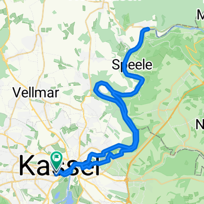
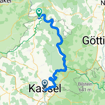
Zu Fuß im Bergpark WIlhelmshöhe
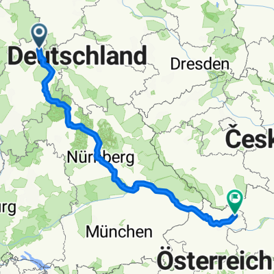
A cycling route starting in Kassel, Hesse, Germany.
Overview
About this route
Hike through the World Heritage site with steep climbs, waterfalls, and views over Kassel and the Fulda Valley.
- -:--
- Duration
- 8.7 km
- Distance
- 350 m
- Ascent
- 351 m
- Descent
- ---
- Avg. speed
- 539 m
- Max. altitude

Continue with Bikemap
Use, edit, or download this cycling route
You would like to ride Zu Fuß im Bergpark WIlhelmshöhe or customize it for your own trip? Here is what you can do with this Bikemap route:
Free features
- Save this route as favorite or in collections
- Copy & plan your own version of this route
- Sync your route with Garmin or Wahoo
Premium features
Free trial for 3 days, or one-time payment. More about Bikemap Premium.
- Navigate this route on iOS & Android
- Export a GPX / KML file of this route
- Create your custom printout (try it for free)
- Download this route for offline navigation
Discover more Premium features.
Get Bikemap PremiumFrom our community
Other popular routes starting in Kassel
 Wurmbergstraße nach Unterarzing
- Distance
- 787.8 km
- Ascent
- 6,897 m
- Descent
- 6,402 m
- Location
- Kassel, Hesse, Germany
 Herkules-Wartburg Mädels
- Distance
- 243.9 km
- Ascent
- 1,035 m
- Descent
- 1,035 m
- Location
- Kassel, Hesse, Germany
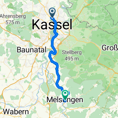 Cassel - Melsungen
- Distance
- 34.1 km
- Ascent
- 332 m
- Descent
- 323 m
- Location
- Kassel, Hesse, Germany
 Kassel nach Melsungen
- Distance
- 41.5 km
- Ascent
- 338 m
- Descent
- 366 m
- Location
- Kassel, Hesse, Germany
 Fuldatour
- Distance
- 42 km
- Ascent
- 437 m
- Descent
- 436 m
- Location
- Kassel, Hesse, Germany
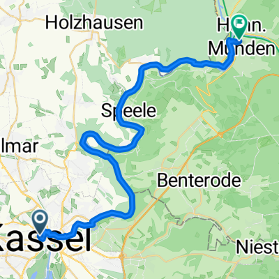 Von Kassel bis Hannoversch Münden
- Distance
- 29 km
- Ascent
- 275 m
- Descent
- 325 m
- Location
- Kassel, Hesse, Germany
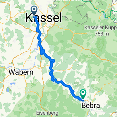 Cassel - Breitenbach
- Distance
- 67.1 km
- Ascent
- 459 m
- Descent
- 506 m
- Location
- Kassel, Hesse, Germany
 Fulda-Radweg Kassel bis Karlshafen
- Distance
- 70.3 km
- Ascent
- 631 m
- Descent
- 714 m
- Location
- Kassel, Hesse, Germany
Open it in the app