

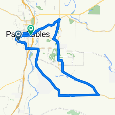
Paso Robles - Estrella to Jardine
A cycling route starting in Paso Robles, California, United States.
Overview
About this route
Something "funky" happens when I upload this route. Map shows stretches on Buena Vista and Circle B Road near Start/Finish. Those should not be on map.
- -:--
- Duration
- 45.3 km
- Distance
- 174 m
- Ascent
- 173 m
- Descent
- ---
- Avg. speed
- 272 m
- Max. altitude
Route quality
Waytypes & surfaces along the route
Waytypes
Quiet road
25.4 km
(56 %)
Road
10.4 km
(23 %)
Surfaces
Paved
6.8 km
(15 %)
Asphalt
6.8 km
(15 %)
Undefined
38.5 km
(85 %)
Continue with Bikemap
Use, edit, or download this cycling route
You would like to ride Paso Robles - Estrella to Jardine or customize it for your own trip? Here is what you can do with this Bikemap route:
Free features
- Save this route as favorite or in collections
- Copy & plan your own version of this route
- Sync your route with Garmin or Wahoo
Premium features
Free trial for 3 days, or one-time payment. More about Bikemap Premium.
- Navigate this route on iOS & Android
- Export a GPX / KML file of this route
- Create your custom printout (try it for free)
- Download this route for offline navigation
Discover more Premium features.
Get Bikemap PremiumFrom our community
Other popular routes starting in Paso Robles
 North River Road 1529, Paso Robles to North River Road 1541, Paso Robles
- Distance
- 19.4 km
- Ascent
- 236 m
- Descent
- 230 m
- Location
- Paso Robles, California, United States
 Paso - Estrella to Union to Linne
- Distance
- 69.9 km
- Ascent
- 377 m
- Descent
- 376 m
- Location
- Paso Robles, California, United States
 Rob north to TEMPLETON to home
- Distance
- 34.8 km
- Ascent
- 172 m
- Descent
- 211 m
- Location
- Paso Robles, California, United States
 Robs Paso Robles Loop 1
- Distance
- 29.4 km
- Ascent
- 216 m
- Descent
- 271 m
- Location
- Paso Robles, California, United States
 Paso Robles
- Distance
- 44.4 km
- Ascent
- 634 m
- Descent
- 618 m
- Location
- Paso Robles, California, United States
 Paso to Atascadero
- Distance
- 23.3 km
- Ascent
- 322 m
- Descent
- 277 m
- Location
- Paso Robles, California, United States
 Tour Californie Paso Robles - Fresno
- Distance
- 179.9 km
- Ascent
- 621 m
- Descent
- 766 m
- Location
- Paso Robles, California, United States
 729 N Trigo Ln, Paso Robles to 729 N Trigo Ln, Paso Robles
- Distance
- 11.3 km
- Ascent
- 62 m
- Descent
- 62 m
- Location
- Paso Robles, California, United States
Open it in the app