

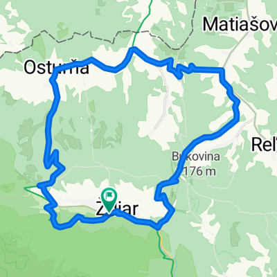
Mesačný okruh
A cycling route starting in Ždiar, Prešov Region, Slovakia.
Overview
About this route
- 1 h 26 min
- Duration
- 18.4 km
- Distance
- 482 m
- Ascent
- 482 m
- Descent
- 12.8 km/h
- Avg. speed
- 1,083 m
- Max. altitude

Continue with Bikemap
Use, edit, or download this cycling route
You would like to ride Mesačný okruh or customize it for your own trip? Here is what you can do with this Bikemap route:
Free features
- Save this route as favorite or in collections
- Copy & plan your own version of this route
- Sync your route with Garmin or Wahoo
Premium features
Free trial for 3 days, or one-time payment. More about Bikemap Premium.
- Navigate this route on iOS & Android
- Export a GPX / KML file of this route
- Create your custom printout (try it for free)
- Download this route for offline navigation
Discover more Premium features.
Get Bikemap PremiumFrom our community
Other popular routes starting in Ždiar
 Ždiar-Osturňa- V.Franková- Niedzica-Zamek (PL)
- Distance
- 21.8 km
- Ascent
- 384 m
- Descent
- 705 m
- Location
- Ždiar, Prešov Region, Slovakia
 Ždiar - Osturňa - Sp.Hanušovce
- Distance
- 40.2 km
- Ascent
- 1,139 m
- Descent
- 1,141 m
- Location
- Ždiar, Prešov Region, Slovakia
 Ždiar, Ždiar to Ždiar, Ždiar
- Distance
- 47.1 km
- Ascent
- 1,405 m
- Descent
- 1,325 m
- Location
- Ždiar, Prešov Region, Slovakia
 Ždiar-Pri Tablici- Magurka- Slodič.vrch- M.Poľana
- Distance
- 17.9 km
- Ascent
- 435 m
- Descent
- 438 m
- Location
- Ždiar, Prešov Region, Slovakia
 Nach Lapszanka
- Distance
- 43.6 km
- Ascent
- 637 m
- Descent
- 637 m
- Location
- Ždiar, Prešov Region, Slovakia
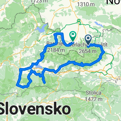 Cycling Tour around the High Tatras
- Distance
- 271.1 km
- Ascent
- 2,226 m
- Descent
- 2,432 m
- Location
- Ždiar, Prešov Region, Slovakia
 Velo Dunajec p.2
- Distance
- 111.3 km
- Ascent
- 2,129 m
- Descent
- 2,383 m
- Location
- Ždiar, Prešov Region, Slovakia
 Tatry
Tatry- Distance
- 188.6 km
- Ascent
- 3,000 m
- Descent
- 3,004 m
- Location
- Ždiar, Prešov Region, Slovakia
Open it in the app