

Hohentannen-Waldkirch
A cycling route starting in Herisau, Canton of Appenzell Ausserrhoden, Switzerland.
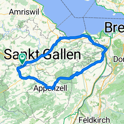
Overview
About this route
Go-BiZl-Hohent-Kaltenbr-Hagenw-Walk-Winkln
- -:--
- Duration
- 58.2 km
- Distance
- 969 m
- Ascent
- 966 m
- Descent
- ---
- Avg. speed
- 888 m
- Max. altitude

Route quality
Waytypes & surfaces along the route
Waytypes
Quiet road
25.6 km
(44 %)
Road
19.8 km
(34 %)
Surfaces
Paved
26.2 km
(45 %)
Unpaved
1.2 km
(2 %)
Asphalt
19.2 km
(33 %)
Paved (undefined)
7 km
(12 %)
Continue with Bikemap
Use, edit, or download this cycling route
You would like to ride Hohentannen-Waldkirch or customize it for your own trip? Here is what you can do with this Bikemap route:
Free features
- Save this route as favorite or in collections
- Copy & plan your own version of this route
- Sync your route with Garmin or Wahoo
Premium features
Free trial for 3 days, or one-time payment. More about Bikemap Premium.
- Navigate this route on iOS & Android
- Export a GPX / KML file of this route
- Create your custom printout (try it for free)
- Download this route for offline navigation
Discover more Premium features.
Get Bikemap PremiumFrom our community
Other popular routes starting in Herisau
 3. Fahrt
- Distance
- 48.4 km
- Ascent
- 627 m
- Descent
- 628 m
- Location
- Herisau, Canton of Appenzell Ausserrhoden, Switzerland
 Rondom Herisau
- Distance
- 17 km
- Ascent
- 465 m
- Descent
- 463 m
- Location
- Herisau, Canton of Appenzell Ausserrhoden, Switzerland
 Herisau-Thur-Herisau
- Distance
- 36.3 km
- Ascent
- 441 m
- Descent
- 442 m
- Location
- Herisau, Canton of Appenzell Ausserrhoden, Switzerland
 Herisau - Sizilien 1. Etappe bis Schlanders
- Distance
- 235.1 km
- Ascent
- 4,691 m
- Descent
- 4,085 m
- Location
- Herisau, Canton of Appenzell Ausserrhoden, Switzerland
 Rondom Herisau
- Distance
- 17 km
- Ascent
- 516 m
- Descent
- 516 m
- Location
- Herisau, Canton of Appenzell Ausserrhoden, Switzerland
 Herisau-Altstätten-Herisau
- Distance
- 80.2 km
- Ascent
- 795 m
- Descent
- 795 m
- Location
- Herisau, Canton of Appenzell Ausserrhoden, Switzerland
 Herisau Oberhelfenschwil Hemberg Schönau
- Distance
- 70.2 km
- Ascent
- 1,925 m
- Descent
- 1,950 m
- Location
- Herisau, Canton of Appenzell Ausserrhoden, Switzerland
 25.05.2014
- Distance
- 32.6 km
- Ascent
- 407 m
- Descent
- 407 m
- Location
- Herisau, Canton of Appenzell Ausserrhoden, Switzerland
Open it in the app