

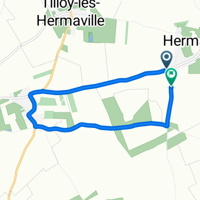
Frévin-Cappelle - Arras
A cycling route starting in Aubigny-en-Artois, Hauts-de-France, France.
Overview
About this route
Route quotidienne pour me rendre à l'école durant l'année 2010-2011.
- -:--
- Duration
- 11.4 km
- Distance
- 60 m
- Ascent
- 78 m
- Descent
- ---
- Avg. speed
- ---
- Max. altitude

Route quality
Waytypes & surfaces along the route
Waytypes
Busy road
3.2 km
(28 %)
Track
2.9 km
(25 %)
Surfaces
Paved
5 km
(44 %)
Unpaved
2.9 km
(25 %)
Asphalt
5 km
(44 %)
Gravel
2.9 km
(25 %)
Undefined
3.6 km
(31 %)
Continue with Bikemap
Use, edit, or download this cycling route
You would like to ride Frévin-Cappelle - Arras or customize it for your own trip? Here is what you can do with this Bikemap route:
Free features
- Save this route as favorite or in collections
- Copy & plan your own version of this route
- Sync your route with Garmin or Wahoo
Premium features
Free trial for 3 days, or one-time payment. More about Bikemap Premium.
- Navigate this route on iOS & Android
- Export a GPX / KML file of this route
- Create your custom printout (try it for free)
- Download this route for offline navigation
Discover more Premium features.
Get Bikemap PremiumFrom our community
Other popular routes starting in Aubigny-en-Artois
 Route bikemap
- Distance
- 203.2 km
- Ascent
- 816 m
- Descent
- 822 m
- Location
- Aubigny-en-Artois, Hauts-de-France, France
 Rue du Chemin de Lattre Saint-Quentin, Hermaville à Rue du Chemin de Lattre Saint-Quentin, Hermaville
- Distance
- 6.1 km
- Ascent
- 40 m
- Descent
- 37 m
- Location
- Aubigny-en-Artois, Hauts-de-France, France
 Frévin-Cappelle - Arras
- Distance
- 11.4 km
- Ascent
- 60 m
- Descent
- 78 m
- Location
- Aubigny-en-Artois, Hauts-de-France, France
 Relaxed route in Servins
- Distance
- 3.3 km
- Ascent
- 41 m
- Descent
- 13 m
- Location
- Aubigny-en-Artois, Hauts-de-France, France
 Sous l'Abbaye, Aubigny-en-Artois à Sous l'Abbaye, Aubigny-en-Artois
- Distance
- 21.3 km
- Ascent
- 209 m
- Descent
- 210 m
- Location
- Aubigny-en-Artois, Hauts-de-France, France
 De 1 Rue des Ayettes, Habarcq à 4 Rue des Ayettes, Habarcq
- Distance
- 6 km
- Ascent
- 56 m
- Descent
- 59 m
- Location
- Aubigny-en-Artois, Hauts-de-France, France
 Rue d'Izel Lez Hameau, Hermaville à Rue du Chemin de Lattre Saint-Quentin, Hermaville
- Distance
- 33.4 km
- Ascent
- 279 m
- Descent
- 281 m
- Location
- Aubigny-en-Artois, Hauts-de-France, France
 3 Rue du Chemin de Lattre Saint-Quentin, Hermaville à 3 Rue du Chemin de Lattre Saint-Quentin, Hermaville
- Distance
- 16.1 km
- Ascent
- 106 m
- Descent
- 109 m
- Location
- Aubigny-en-Artois, Hauts-de-France, France
Open it in the app